All posts by David Schalliol

New Book: Isolated Building Studies

I am excited to announce that the Japanese photography book producer Utakatado has just published Isolated Building Studies, the first book dedicated to my Isolated Building Studies project. The 56-page softcover book is 7.5″ x 11.5″ and features 36 of my favorite photographs from the series, including the images in the below thumbnails. Additional images of the book from the publisher are below the thumbnails.

The book is already available in Asia, but it will be a couple of weeks before it is available in the U.S. without shipping directly from Japan. In the meantime, if you are outside of Asia and would like a copy, you can purchase the book from me using the PayPal link below. The book is $19 (tax included), plus $4 for shipping within the U.S. (contact me for pricing for other destinations). I should be able to get the books in the mail one workday after an order is placed, with the first orders going out on Friday.

UPDATE: Isolated Building Studies has been featured by a variety of publications including Dwell, Chicago magazine and Gizmodo. It is now also stocked by Chicago bookstores Quimby’s and 57th Street Books.

I’m both sorry and happy to say that the book is sold out in the United States, but there is still limited stock through UTAKATADO in Japan.


After the Japanese Disaster and into the Fukushima Exclusion Zone

Last week I traveled with Japanese advertising director and photographer Yohei Morita through Tōhoku, the Japanese region critically affected by the March 11, 2011 earthquake, tsunami, and subsequent nuclear disaster.

Tōhoku is wedged between the Sea of Japan and the Pacific Ocean on the northern portion of the country’s largest island, Honshu. Compared to southern Honshu and its major cities, the region is rural and less habitable, even along the coastlines. The island’s volcanic and tectonic history are clear there, where the coastal hills make way for the Ōu Mountains and its national parks, hot springs and temples, including the famous Yama-dera temple complex that dates back to the ninth century.

Yama-dera Temple Complex
Yama-dera

The landscape that makes the coastal regions of Tōhoku so lovely amplified the disaster. While most of the region escaped unscathed, along the eastern section of the coast, the mountains and hills make way for the dozens of small bays and river valleys that became the locations of small towns. For hundreds of years, residents of these towns lived side-by-side with their rice paddies and fishing fleet harbors, and the hills above were the locations of shrines and timber harvesting. When the tsunami struck, it rose as high as 130 feet, immediately overwhelming many eastern coastal harbors and surging up the rivers, which jumped their banks and flood-walls. Whole towns were nearly destroyed. The Japanese government estimates that more than 18,000 people lost their lives, and another 340,000 were displaced.

Building on its Side
Building on its Side, Onagawa

Towns and business that were farther inland quickly became safe harbors for the residents who survived. Among others is Oiwake Onsen, a traditional spring inn near the nearly submerged town of Onagawa, which became the home for two dozen elderly town residents. They lived in the inn for nearly six months while the cleanup and rebuilding occurred.

IMG_7209 Onsen
Oiwake Onsen

Nearly three years since the disaster, many of these towns have been cleared of most debris and now resemble fallow fields. Where new buildings do dot the landscape, they are typically prefabricated structures or even converted shipping containers. While driving along the coastal roads, we would often emerge from the hills to find a cemetery on the edge of the field. It replaced the town. Survivors have also constructed shrines near the disaster sites, including the Okawa primary school where 74 children and 10 teachers perished when the surge breached the river banks 30 minutes after the earthquake.

Ogatsucho Mizuhama
Ogatsucho Mizuhama

Ishinomaki by the Ocean
The Coast of Ishinomaki

Cemetery Along the Kitakami River

Christmas Tree and Memorial, Ogatsucho Kamiogatsu

Okawa Elementary School and Temporary Memorial
Temporary Memorial Outside Okawa Elementary School

Few of those residents who survived the disaster have returned home. Some live in nearby resettlement camps that are safely placed in the hills. Many have left the rural areas for regional cities like Sendai City or Ishinomaki, but others have left for Japan’s metropolises, including Tokyo and Kobe.

Resettlement Housing
New 23 Unit Housing Complex Outside Onagawa

Instead of houses, construction work fills the area. Whole fleets of trucks are at work removing debris and moving the earth to fortify embankments, build roads and prepare other kinds of infrastructure. This construction work provides one new source of regional employment, including for unskilled labor like the sweepers that flank each site. Rebuilt fishing harbors are being put to limited use, and timber and oyster production is scaling up. Tourism is even increasing in the region, like at the Zuiganji temple and the nearby Matsushima Bay. Still, even major towns like Ishinomaki — which celebrated removing all disaster debris on the day we arrived — are suffering from economic conditions beyond the direct effects of the tsunami and earthquake.


Trucks Along the River
Trucks Waiting for a Stoplight Along the Kitakami River

Rebuilding a Road and River Barrier
Rebuilding a Road and Kitakami River Barrier

IMG_7287_8 Shellfish Production
Lumber and Shellfish Production in Miyagi Prefecture

Quiet Arcade Street in Ishinomaki

Ishinomaki
Ishinomaki from Above, with Reconstruction Underway

Zuiganji Temple
Zuiganji Temple Grounds

Despite all of this activity, one area remains nearly as it was on the day of the earthquake: the Fukushima Daiichi nuclear power plant exclusion zone. One of two nuclear power plants along the Fukushima Prefecture coastline, the Fukushima Daiichi plant was compromised by the tsunami and suffered catastrophic failures over the following few days. The explosions and other problems led to the release of radioactive material into the air and ocean. The Japanese government instituted a mandatory evacuation for residents in a 20km and then 30km radius; however, the evacuation zones were initially designed to protect against contamination from an explosion, rather than the distribution of radioactive material through wind and other weather patterns. The result was many residents were exposed to radioactivity despite the government response. Those in the areas to the northwest of the plant — even those outside of the exclusion zone — suffered the highest contamination, although radioactive hotspots are located over northern and central Honshu, including in Tokyo. Still, the government is quick to point out that the amount of radiation released was considerably less than that at Chernobyl, and scientists currently anticipate only slight increases in cancer rates among most of those exposed. We can hope.

Today, several towns within the exclusion zone remain evacuated. They are primarily frozen in time, ghost towns that — until very recently — were left as they were three years earlier. Emergency crews are removing radioactive material and have removed some debris from the streets, but nearly everything else is as it was on the day of the disaster. Cars are upturned, houses are open and plants sprout everywhere.

Thanks to Deputy Mayor Hirofumi Sanpei, we visited the small town of Tomioka that sits on the edge of the exclusion zone and is still closed to the general public. It had a population of more than 16,000 before the disaster and is located next to the other nuclear power plant in the region, the Fukushima Daini Nuclear Power Plant. Just beyond its boundaries is the former J-Village national soccer complex that is the major staging area for the recovery effort.


Deputy Mayor Hirofumi Sanpei
Deputy Mayor Hirofumi Sanpei Indicates Where We Will Travel

Upturned Cars, Downtown Tomioka

Downtown Tomioka
Downtown Tomioka Street

Shop Window
Downtown Tomioka Shop Window

Downtown Tomioka
Downtown Tomioka Street

Downtown Tomioka Shop
Downtown Tomioka Shop, Clock Stopped at the Time the Earthquake Struck: 2:46pm

Memorial Flowers
Memorial Flowers by the Main Tomioka Train Station

The town itself remains blanketed in low levels of radiation. Official radiation monitors are exclamation points in the landscape, announcing the immediate radioactivity readings in microsieverts (μSv) per hour. The areas we visited ranged between 0.07 μSv in the mountains to 4.5 μSv near one of the town’s former train stations. My personal monitor was generally between 0.2 μSv and 0.7 μSv. [For more data about radiation in the Fukushima disaster area, visit Safe Cast or this national map display.]

To put the readings into perspective, the United States Environmental Protection Agency estimates that a chest x-ray contains between 20-50 μSv, and radiation exposure on a cross-country flight is as much as 50 μSv. In other words, I experienced more radiation during my flight to Japan than in the few hours I was in the exclusion zone, although the kinds of radiation I experienced near Fukushima were more likely to be absorbed. To reduce the amount of absorption, I wore some protective clothing, a mask to avoid inhaling contaminated dust on a windy day, and shoe coverings, which were provided by and tested for radioactivity by Tokyo Electric Power Co. when we left the region. They were “clean.”


Radioactivity Monitor, Closed Section of Tomioka
Radioactivity Monitor in Tomioka Reading 4.119μSv per hour

While the general public is not permitted to access the town, most residents have been recently allowed to return to survey damage to their property, although they are not permitted to move back into their homes. The delay is partly caused by the radiation and partly caused by infrastructure problems. The result is that most of the town remains eerily quiet, even though a massive recovery effort is underway.

The most visible signs of the recovery effort are the construction vehicles on the main roads, the large piles of bags of contaminated soil, and the white plastic of temporary roof repairs. Still, some areas of higher contamination are off-limits even to the town’s residents. The blockades are visible on GPS systems, and officers working road checkpoints require official government permission to enter. Beyond these areas, the evidence of the earthquake is clearer and few repairs have occurred.

Roadblocks on GPS Roadblock in Tomioka
Roadblocks in Tomioka

Workers, Tomioka
Workers, Truck Moving Soil in Tomioka

Abandoned Yonomori Train Station
Abandoned Yonomori Train Station in Tomioka’s Heightened Exclusion Zone

Street in the Heightened Exclusion Zone
Street in Tomioka’s Heightened Exclusion Zone

Bagged Radioactive Debris
Bagged Radioactive Debris Outside of Tomioka

After we left the area, we headed into the mountains to the village of Kawauchi. The village was affected by the earthquake but was the immediate destination for Tomioka residents fleeing the tsunami. As many as 6,000 residents jammed the scenic mountain road and tunnels that lead to the town and were then housed in schools and other sites. All were then evacuated from Kawauchi when the nuclear evacuation order was executed.

Significantly fewer residents live in the town since the evacuation order was lifted on April 1, 2012. Two of the three elementary schools have closed, and only a handful of students remain in each grade. The radiation levels in the town were the lowest we experienced in the region, at only 0.07 μSv. Area residents are tentatively optimistic about the area’s long-term prospects, but the future is unclear for this town and many others in the region.


Kawauchi Street
A Kawauchi Main Street

Kawauchi Elementary School Class

The entire eastern coast is working its way to recovery, but it will take generations assess the total cost of the great Tōhoku disaster. Officials continue to grapple with containment issues at the Fukushima Daiichi Nuclear Power Plant, and residents and government agents continue to scale up the recovery effort. At present, the government estimates it will re-open Tomioka by 2017, although there are questions about who will return. Nuclear energy and tsunami and earthquake preparedness are being discussed around the country, where even the Tokyo governor race is becoming a de facto referendum on the government nuclear response. Japan’s nuclear future may hang in the balance.

Special thanks go to Yohei Morita and Tomioka Deputy Mayor Hirofumi Sanpei, whose assistance was essential to producing this essay.

Chicago at -15 Fahrenheit

Promontory Point in the Vapor Obligatory Downtown Chicago View from Northerly Island
Towards the Jackson Park Outer Harbor Looking North

Over the last several days, the Chicago region experienced as much as 18 inches of snow and temperatures as low as -15 Fahrenheit (roughly -26 Celsius). I love how snow transforms the city and how low temperatures affect the visibility of water vapor, so I headed out to get a sense of the South Side and Northwestern Indiana.

The following is a selection of my favorite photographs from my outings. As always, you can click through to see larger versions of the photographs on flickr.


In the Cold

Streetlight, In the Snow

Residential Building, L

Steam

Looking North

From the Rail Embankment

In the Snow

A Year of Projects and More Travel

2013 was yet another year of big changes: I finished my fieldwork for my dissertation; I started regularly spending time in both Chicago and Cambridge, Massachusetts; and I started a major shift in the balance of my photographic and video work.

In previous years, I pursued a relatively equal combination of project and non-project work. Typically, that’s meant spending as much time developing formal projects as more loosely exploring a given city. This year, I have been so busy with the formal projects that I have had much less time to “just” explore.

I worked on the documentary film (still tentatively called “The Area”) more than any other project, although I even shifted that balance. I was visiting the neighborhood nearly every day for the first half of the year, but I am now visiting in concentrated chunks. I dedicated much of the time I would have spent in the neighborhood to either writing about the project or initiating post-production work with Scrappers Film Group. If you would like to read some of my writing about the project, I have been authoring a column about the work for BagNewsOriginals. If you haven’t seen the documentary short from the project, you can view it on Gapers Block.

Of the other projects, two of my favorites were documenting Bertrand Goldberg‘s Prentice Women’s Hospital and contributing to the Kartemquin Film’s Almost There. While Prentice’s magnificent exterior presented the usual opportunities and difficulties involved with documenting buildings, the interior documentation was particularly challenging. By the time our team was allowed access to the building, Northwestern University had already begun some elements of the demolition, and the many of the floors lacked electricity for anything other than emergency lighting. Still, the experience was unforgettable, and I am happy with the work we produced. Hopefully the next building will be saved.

I’ve included example photographs from those projects below, along with selected images from my visits to other U.S. cities. You can click through for larger versions of the images on flickr (except for the Prentice images) and can click on the titles to see other blog posts or flickr sets.

The Area

Walking in the Snow

In the Shoe Sign Shop

Prentice Women’s Hospital

Prentice Women's Hospital

Prentice Women's Hospital

The following is a short advocacy video we made for the National Trust for Historic Preservation about Prentice.

Almost There in Northwestern Indiana

Ice, After the Fire

Whiting, Indiana

Atlanta, Georgia

Johnny E. Parham, Jr., Participant in the Atlanta Student Movement

Wheatpasted photograph of Johnny E. Parham, Jr., participant in the Atlanta Student Movement from Sheila Pree Bright’s Project 1960.

Birmingham, Alabama

Bragg Cleaners & Record Shop

Boston, Massachusetts [f]

Walking Home

Covered Car, Boston Skyline

Buffalo, New York

Buffalo, New York Telescope Houses

A collection of telescope houses from Buffalo’s East Side.

Chicago, Illinois [f]

Residential Building in the Fog

Iced Truck, After the Warehouse Fire


A surprising find in the aftermath of a massive warehouse fire on Chicago’s South Side.

Cleveland, Ohio [f]

Modified Post-War Suburban Homes

Post-war suburban development in Cleveland-adjacent Euclid, Ohio.

Detroit, Michigan

Sweeping the Sidewalk

House of Soul (Now Burnt)


The House of Soul was one of several Heidelberg Project buildings burned by an arsonist in 2013.

New York City, New York [f]

Scaling Fish on the Sidewalk

Scaling fish on the sidewalk in the Bronx.

San Diego, California [f]

Silver Gate Three Stars Lodge #296

Birmingham, Alabama and Atlanta, Georgia


Urban Cowboy and Mural

Last week I traveled to Atlanta, Georgia to co-present a paper at an academic conference and spend a little time exploring in the region. I only had parts of three days away from the conference, but thanks to some planning, I was able to accomplish more than I anticipated. The following photographs are some of my favorites, although you can see others on flickr; clicking on any of the below photographs will also take you to flickr for larger versions of the images.

As usual, most of the highlights involved interactions with people doing what they love. The above photograph is of an urban cowboy named Brannu who runs an equestrian organization and is planning on offering horseback riding lessons in the pictured lot. I spent a little time walking around with him while he visited restaurants and barbershops in the Sweet Auburn neighborhood — until he headed in for lunch at a restaurant with Chicago connections. The mural behind him is by Mexican street artist Neuzz, who made the piece for last year’s Living Walls conference.


Talking to Brannu Urban Cowboy

I had similar experiences in the Vine City neighborhood, which is in the shadow of the (now likely doomed) Georgia Dome. I’ll share the interactions later, but visiting in November was quite a change from the kudzu-covered August: the receding foliage provided clearer views of the neighborhood’s context.

Toward the Georgia Dome

The last time I was in Atlanta, I headed east to visit Sparta, Georgia, so this time I decided I to head west to Birmingham, Alabama. Other than being curious about the city, I was particularly interested in visiting important sites of the civil rights movement and Dawoud Bey‘s Birmingham Project exhibition at the Birmingham Museum of Art.

Among historic locations, I visited several churches, including the 16th Street Baptist Church, below. They are among the many thriving places in the city, but I was struck by the hardships still endured by residents of the historic neighborhoods that were so important to the birth of the civil rights movement. The two photographs below that of the church are representative of many of the older, unoccupied homes located in Collegeville, the home neighborhood for Reverend Fred Shuttlesworth‘s Bethel Baptist Church.


16th Street Baptist Church
Residential Building Residential Building Residential Building

A standout from Birmingham was talking with Ennis Bragg, the owner of the North Side Bragg’s Cleaners and Record Shop. He started the business thirty years ago and has been experimenting with a variety of services and products ever since. The records may be gone, but he still sells everything from CD of his gospel group, The Golden Hummingbirds, to groceries and laundry services. If you’d like you listen to a song from his group, launch the WFMU pop-up player for this episode and slide the bar to 49:24. The song is “He’s Listening” from 1964.


Bragg Cleaners & Record Shop
Ennis Bragg in His Shop

Visit my Alabama and Atlanta and Sparta, Georgia flickr sets for additional photographs and notes from my visit.

Almost There in Northwestern Indiana

As regular followers of my flickr stream know, since January I have been producing environmental video for the Kartemquin Films documentary Almost There. The film follows an 82-year-old artist who lives in the Northwestern Indiana region, and my goal was to provide a sense of the landscape in relation to his important life events.

While I don’t live far from the Indiana border, the Northwestern Indiana communities are outside my daily routine, so I was excited to have the opportunity to focus on the region. While my main work was video, I photographed many of the scenes and spent some time photographing my own subjects. I’ve selected a few of my favorite images from that work in Hammond, Whiting and East Chicago and included them below. Click on any of the images to view them bigger on flickr.

Look for Almost There on PBS next year. In the meantime, you can receive updates on Facebook and Twitter.

Whiting, Indiana

In the Steam

Ice, After the Fire

Good Shepard Apostolic Church

Burning

Cool Creations

Houses, Steam

At Night

Marktown Street at Dusk

In the Alley

In Whiting

Mills Electric Co.

In the Alley, Beyond

Visiting Detroit the Day it Declared Bankruptcy

Sweeping the Sidewalk

The news about Detroit’s bankruptcy broke as I finished packing the car for the four hour drive across Michigan. We weren’t visiting Detroit to cover its bankruptcy and didn’t seek out the choreographed events looping through the headlines. Other than bumping into a press conference complete with half a dozen news vans and plenty of grey and blue suits, there was little to even suggest the announcement had been made.

It’s unclear how the bankruptcy will affect everything from pensions to city services, but life away from the news cameras carried on roughly as normal: people visited parks, cleaned up streets and ate at restaurants. The landscape remained as dynamic as always. Detroit didn’t simply feel like “a city on the brink” or “a half-century of decline” and it certainly wasn’t scored with ominous electronic music. It felt like every day in Detroit.

The following is a small selection of photographs over the course of the visit. For more of my Detroit work, visit the Detroit gallery on my website, my post about life with Detroit’s failing streetlight system and my flickr set.

Millwood Apartments

With the Birds

Closing Up Shop

Dog in the Doorway

The Telway 6820

Johnson's

Loncheria El Parian

The Buffalo Telescope House (and Some Silos)

Last week I returned to Buffalo, New York for the Society of Architectural Historians‘ annual meeting. As usual, I took advantage of the combination of arriving early and a little free time to explore the city. While my last trip was primarily dedicated to photographing the great buildings of the city’s expansion era, I had greater latitude this time around. I’ve pulled out some favorite images below, but feel free to visit flickr for additional photographs from both trips.

I was most intrigued by the city’s preponderance of “telescope houses,” or buildings that were enlarged through rear additions that incrementally reduce in scale. The result is houses that seemingly could be collapsed into themselves.

Buffalo Telescope House 5

The buildings are located throughout the city but are clustered on the East Side. There, the combination of small houses, narrow lots, growing families and limited resources seems to have led to the distinctive expansion patterns. Years of concentrated divestment and neglect now provide windows into back and side yards to view the full depth of the houses.

Buffalo, New York Telescope Houses

The wide-open views also reveal the tenuous condition of many of the buildings — and the neighborhoods as a whole.

Buffalo, New York Telescope Houses, 2

While I spent a couple of days documenting the telescope houses, I still made time for the city’s remarkable grain elevators. A few photographs of those better-documented Buffalo structures are below.


Buffalo, New York Grain Elevator

Deer, Grain Elevator

In Silo City

Houses, Grain Elevator

In Between Detroit’s Failing Streetlights

With Detroit’s pending emergency manager likely addressing the city’s failing streetlight system, and business groups funding streetlights on their own, I thought it was time to post an excerpt of a project on which I’ve been working since 2009.

When I moved from Chicago to Southwest Detroit for the summer of 2009, I was determined to photograph more than the ubiquitous Detroit “urban exploration” scenes. To do so, I developed strategies to photograph the built environment that could contribute to the discourse about Detroit rather than simply reinforce the dominant perception of the city as someting like an urban wasteland.

One strategy was borne from reflecting on the few functioning streetlights off of the arterial routes. While most every neighborhood in Chicago is fairly well illuminated, Detroit neighborhoods are not. Even my street in an active neighborhood in Mexicantown was totally unlit until about a month into the summer, when one light bulb was installed in one of the many streetlight posts.

One consequence of this neglect is that residents often provide their own light. Porch lights and commercial floodlights punctuate darkness nearly as frequently as do public utilities. Streets take on a patchwork appearance from the hues of private light sources: the bluish whites of fluorescent signs, reds of neon gas and pale yellows of porch lights. This private provision of a public utility is begrudgingly maintained like so many other services in Detroit: perhaps as equally from altruism as protection. Consequently, the relationship between individuality and community that is obscured elsewhere by the passivity of the disinterested taxpayer is exposed by the immediate need for action.

As such, the images in this series do not dwell on the absence of streetlights; instead, they focus on the relationship between lightness and darkensss. In so doing, I hope that they serve as a reminder of the commonality produced by casting light into one’s community.

Another selection of this work was originally published in Tinne Van Loon‘s 2010 book, Impressions of Southwest Detroit. Additional photographs from my Detroit work can be viewed on the main website.


Lit Sides

Lights

Family Treat

Illumination

Alpha Super Market and Liquor

The Fire: Walking by a House in the Haze

Illumination, Rain (and a Little Lightning Glow)

Streetlights, or the Lack Thereof

Nemo's

The Fire:  Walking, Liquor Sign in the Haze

Jaye Dee's Mart at Night

A Year of Demolition in Chicago (and Some Travel)

After filling 2010 and 2011 with travel, I changed gears in 2012 to spend most of the year in Chicago working on two local projects.

The first was the Richard H. Driehaus Foundation supported To be Demolished series, in which I photographed 100 buildings threatened with demolition throughout the city. Among my goals for the project was to get a sense of the range of buildings lost, from minor buildings receiving no public attention to those in the limelight. The full series is viewable on Gapers Block, and you can read more about it in this column by Mary Schmich.

To be Demolished Screen Shot

The second Chicago project was the simultaneous undertaking of my dissertation and a documentary film about a group of South Side Chicago residents who are being displaced. I will be posting more about that work within a month; in the meantime, here are a few frames from the film. Update: The film is now online, and I’ve included it above the screenshots.


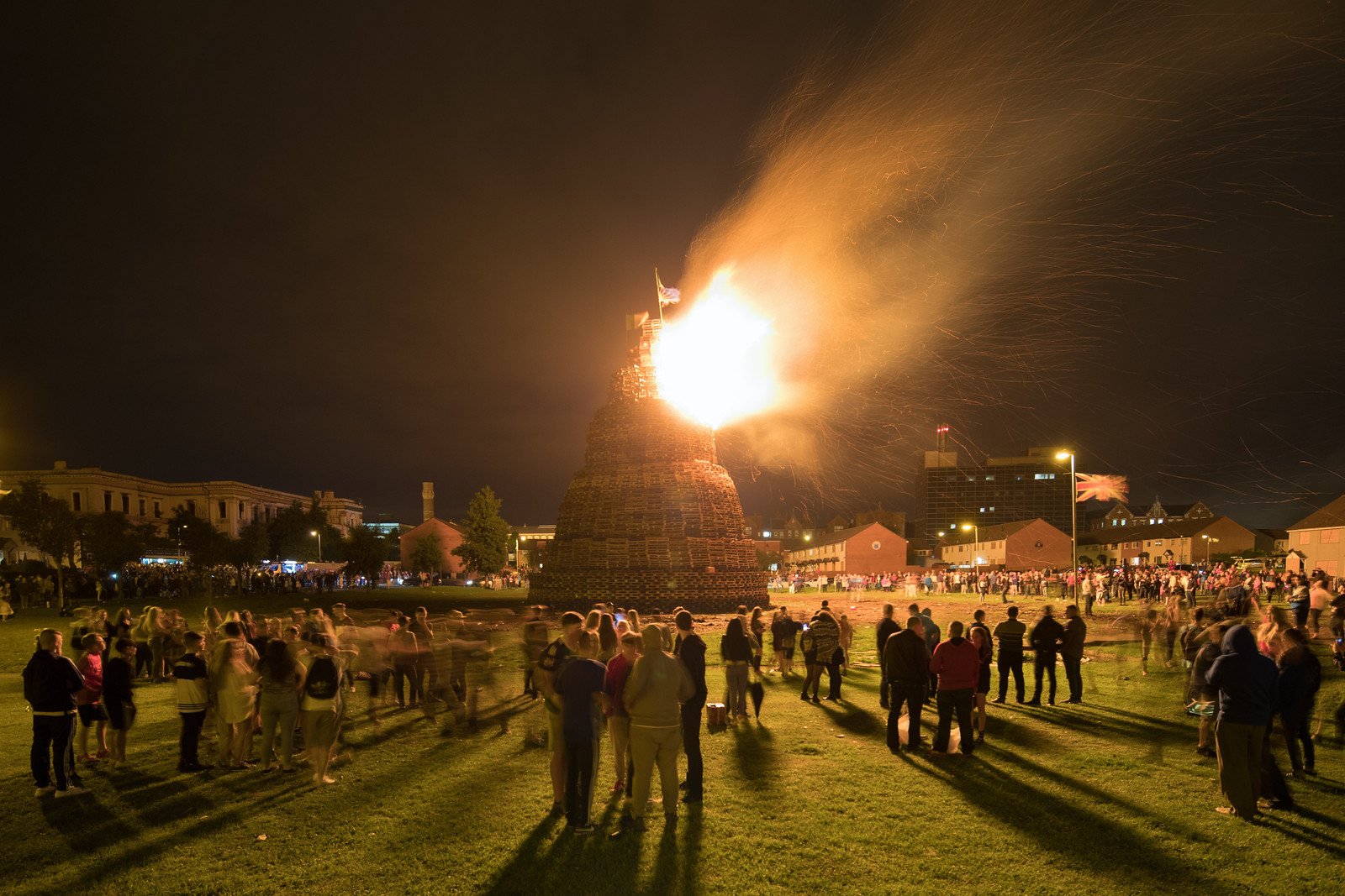
While the local initiatives kept me busy, I still found time to extend projects in Belfast, Northern Ireland and nine other U.S. cities. I visited Belfast to continue documenting the activities of Eleventh Night and The Twelfth, and most of the U.S. visits were structured around wrapping up the fieldwork component of my collaborative effort with Michael Carriere, which I’ve previously mentioned on the blog and was written up in The Atlantic Cities.

Below I present a selection of photographs from most of those cities, alongside a few more from the Chicago area.

Elsewhere in the Chicago Region

With Train Yard, Fog and Car

In Their Garage

Marktown, Indiana Aerial Looking East

From Across the Street

Belfast, Northern Ireland


Burning the Kids' Bonfire

Building a Bonfire

Buffalo, New York


Towards the New York Central Terminal (Buffalo)

Cincinnati, Ohio


Frank's

Chama, New Mexico


Through the Trees

Cheyenne, Wyoming


In the Parking Lot

Denver, Colorado


Gothic Theater

Detroit, Michigan


Walking in the Morning

Indianapolis, Indiana


Dried Pond, Houses

Milwaukee, Wisconsin


At the B & C Lounge