-
Modernism and a 500 Year Anniversary in Le Havre, France
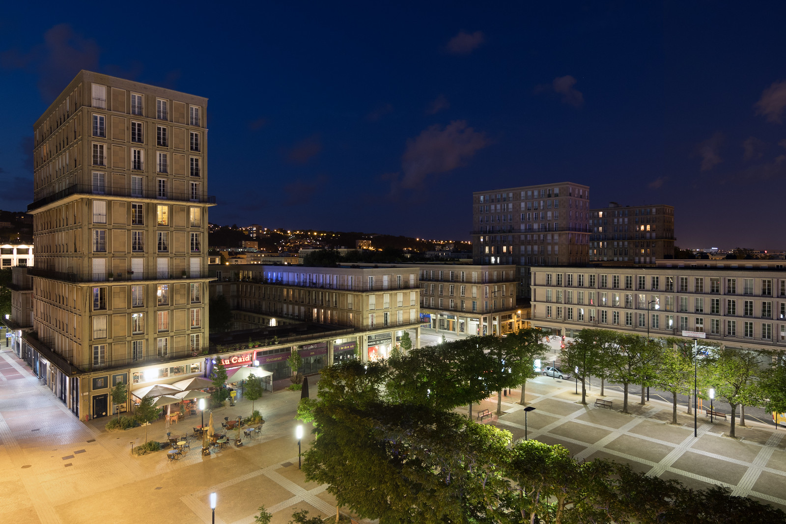
Mixed-use buildings with residential towers overlooking Place Auguste Perret A modernist city designed by Le Corbusier’s mentor, Auguste Perret, sits on the coast of Normandy. Le Havre’s concrete origins date to September 1944, when the British bombed the German-occupied city’s coastal plain. The assault almost completely destroyed the district and killed more than 5,000 people.…
-
Ethiopian Concrete
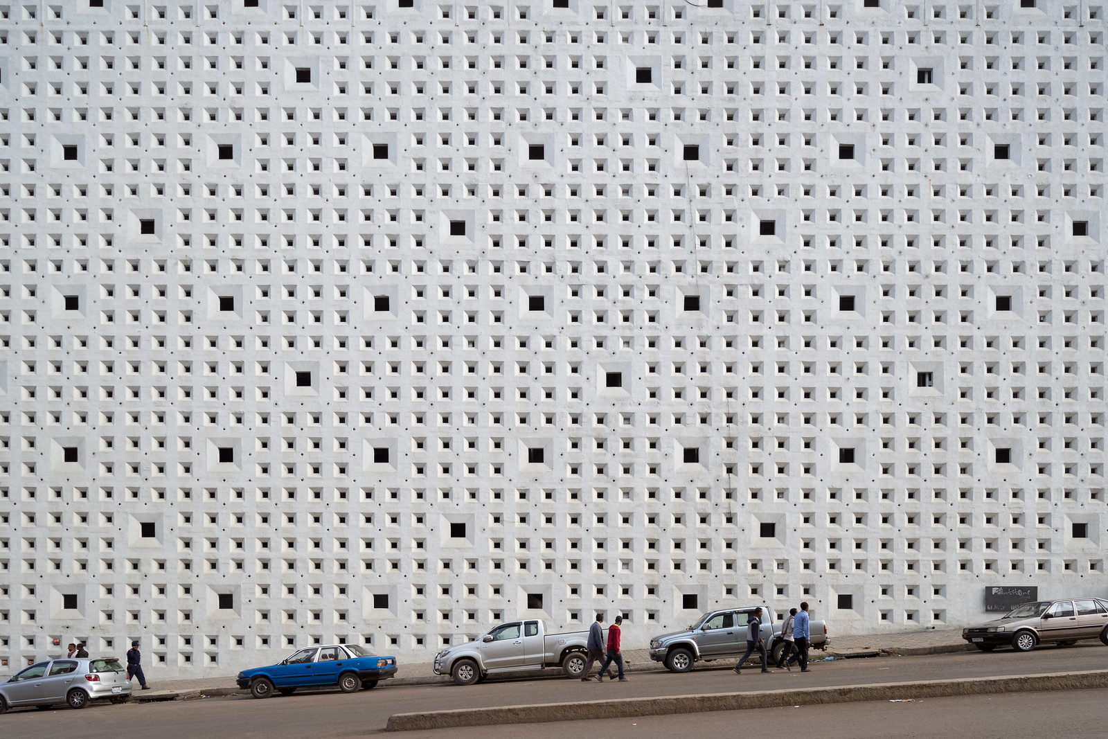
One of the things I was most excited about for my visit to Ethiopia with Brian Ashby and Susannah Ribstein was the opportunity to see its modernist buildings. The thing was, I didn’t really know what we would see. African modernist architecture is chronicled in books like African Modernism: The Architecture of Independence or celebrated…
-
2016 in Review: Nearly As Much There As Here
2016 was another year of travel, but unlike previous years, my explorations were more international than domestic: for more than two months I made work in Belgium, Ethiopia, France, Ireland, Japan, Northern Ireland, and the United Arab Emirates. One month of that period was for a residency in the North of France and Belgium. The…
-

New Orleans, Louisiana
I hadn’t been to New Orleans in more than five years when I landed at Louis Armstrong on Tuesday, so I was anxious to get back out in the city. I squeezed in a few hours of exploration in between two-and-a-half days of conference activities, including following up on my long-running project with Michael Carriere…
-

Rebuilding from the 2011 Tohoku, Japan Disaster
The distinctive rebuilding of the Sendai coast When Yohei Morita and I visited Tōhoku, Japan in 2014, I was most affected by the areas decimated by the tsunami — but it wasn’t for the reasons one might imagine. With the exception of the cities still in the radiation exclusion zone, most of the quarters destroyed…
-
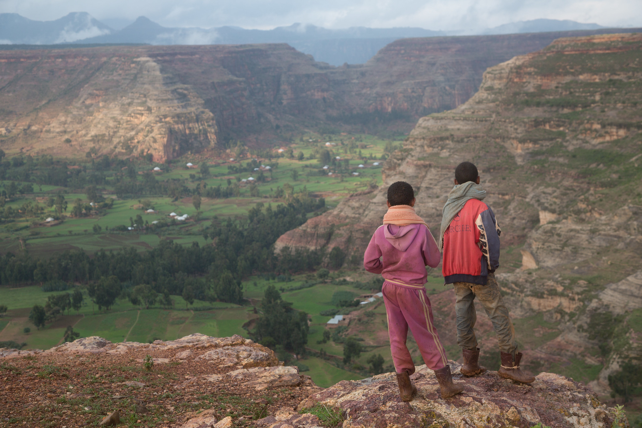
The Battle Between Ethiopian Boys and Monkeys
The cliffs and plateaus of the Agame massif. One of the unexpected experiences of my trip to Ethiopia’s Tigray region was witnessing the daily conflict between local boys and gelada monkeys. Endemic to Ethiopia, gelada monkeys are especially plentiful in the country’s central northern mountains. While some of these areas are protected “natural” lands, a…