There must be more maps of Illinois displayed on Chicago’s South and West Sides than anywhere else in the state.
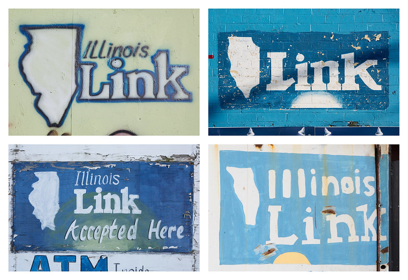
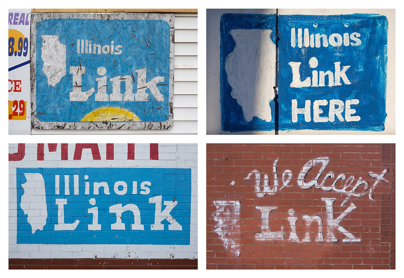
 The hand-painted illustrations are rendered on store walls and windows with thick house paint, spray paint, and even airbrushing. Some maps are remarkably accurate, while others more closely resemble teeth, Africa, or even Castellane pasta.
So why are there so many such maps? Illinois Link.
Illinois residents who receive federal Supplemental Nutrition Assistance Program benefits or income assistance receive a “Link” card. This credit card-like “Illinois Electronic Benefit Transfer” card may be used to purchase food (or seeds/plants to produce food) at approved stores or, in the case of cash benefits, withdraw money at ATMs and debit card machines.
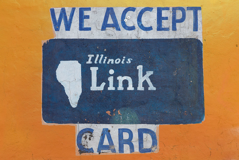
What’s crucial to the map propagation is that for years, the design of the physical card included a map of Illinois. One of the consequence of that design choice was that stores who wanted to advertise that they accepted the Link program would include the outline of the state on their store wall or window.
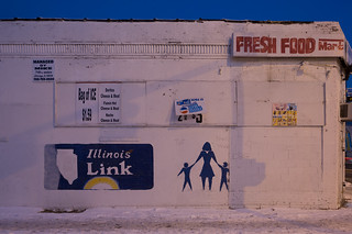
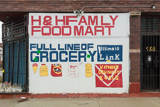
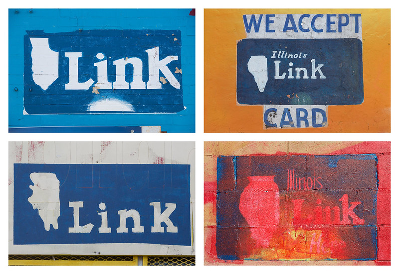
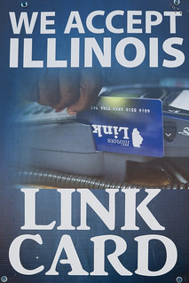
In most cases, the “We Accept Link” signs were professionally prefabricated signs, some that even contained actual photographs of a Link card. But throughout Chicago’s South and West Sides, small corner stores forwent vinyl or silkscreen signs for hand-painted logos. Today, artists’ representations of the card float alongside hand-painted advertisements for “fresh food,” detergent, juice, and other staples.
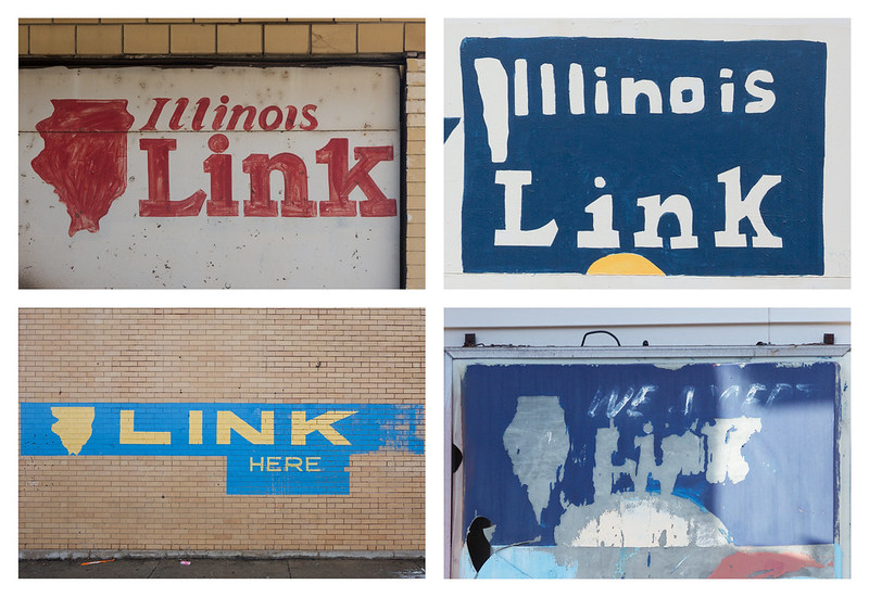
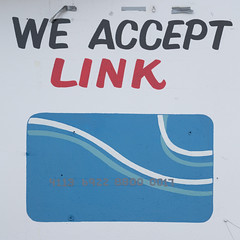 However, a new Link card design was issued in 2013 with “a simpler design … chosen to look like other credit/debit cards, a smaller logo placed on the back of the card, and a 16 digit Personal Account Number (PAN).” With this major design change, the map of the state of Illinois is less prominently featured, and paintings featuring the new design are already popping up on stores, like the sign on the right from a South Side convenience store.
As a lover of maps (and the state of Illinois!), I hope the hand-painted renderings will continue to decorate walls, but I expect they will gradually be replaced by more generic Link advertisements. In case that happens, I’ve assembled a sample of my collection of my photographs of the logos here at the encouragement of my friend and collaborator Brian Ashby.
I sporadically photographed these signs during the last several years, but I’ve stepped up my documentation in recent months because I’ve noticed an increasing number of derelict renderings of the state, perhaps in response to the card redesign.
I may post more examples in the future, but this group demonstrates the range of the signs for now.