Category: Photograph
-
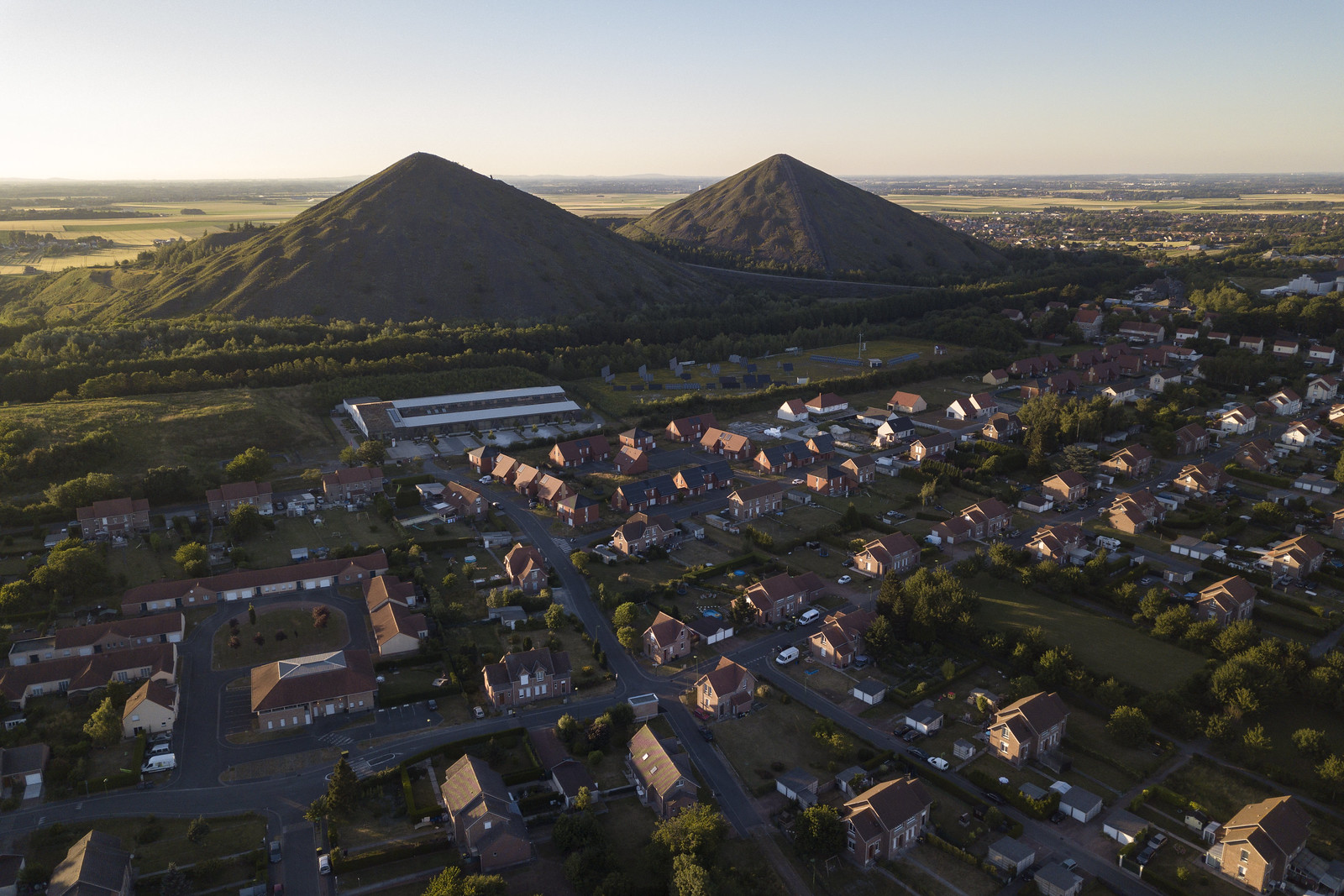
The Terrils of the Nord-Pas-de-Calais Mining Basin
Rising over the towns of the UNESCO-listed Nord-Pas-de-Calais Mining Basin are terrils, or spoil tips, human-made hills of mining debris more than 450 feet tall. During my recent trip to France to screen The Area and participate in RDV avec la Ville, I expanded my Hauts-de-France Mining Basin series with aerial images that highlight their…
-
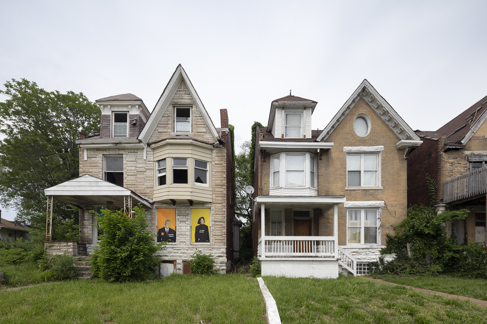
St. Louis, Missouri
This May wasn’t my first time in St. Louis, but it was the first time I was able to actually get out into the neighborhoods. This post includes some of my favorite photographs from throughout the city, many of which are from its north side. While St. Louis has had a difficult 70 years, the…
-
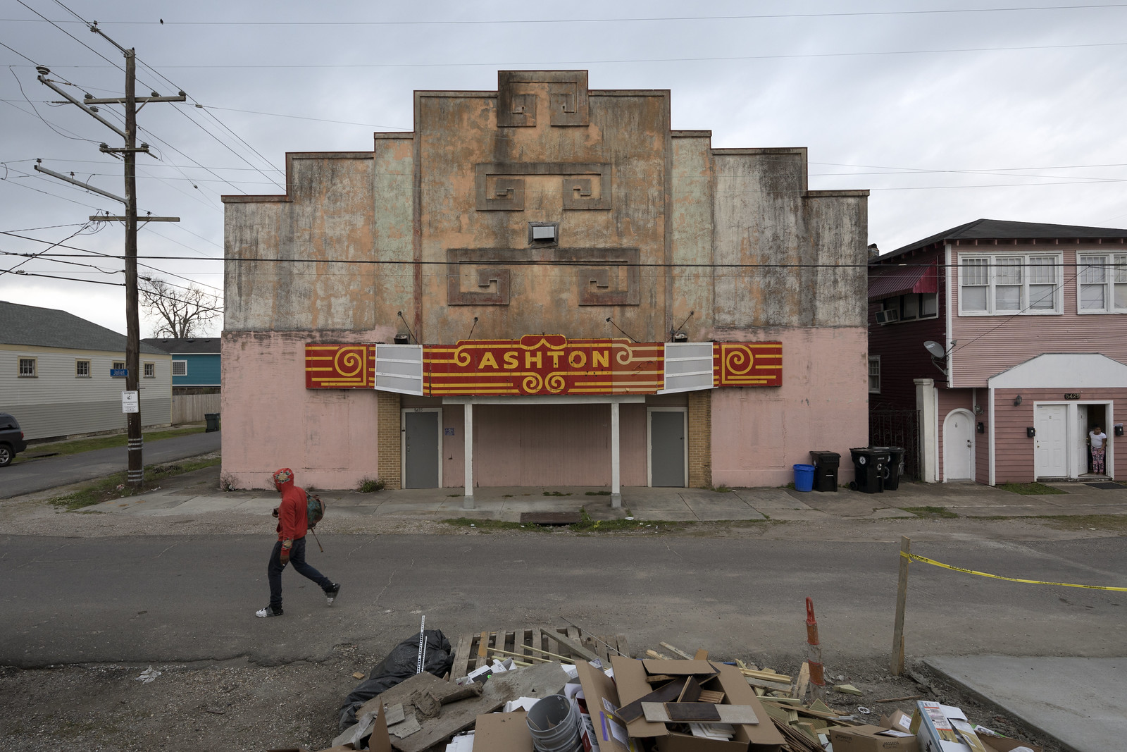
St. Patrick’s Day in New Orleans, Louisiana
In March, I was in New Orleans to participate in the annual Tulane School of Architecture Design Symposium and was happy to have some extra time to make new work. I’ll share images from an ongoing project later, but for now, I’ve included a few other favorites below. At the end is a small set…
-
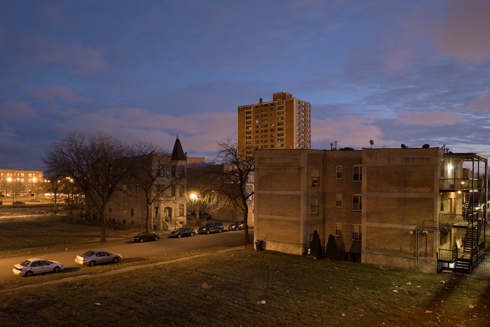
The 2017 Triangle
After a string of years bouncing around the map, in 2017 I mainly traced the triangle between Minneapolis, Chicago, and France. I spent most of my time teaching at St. Olaf and wrapping up The Area in Chicago, but I dedicated nearly two months to two different French projects. In January, I continued my “Resilient…
-
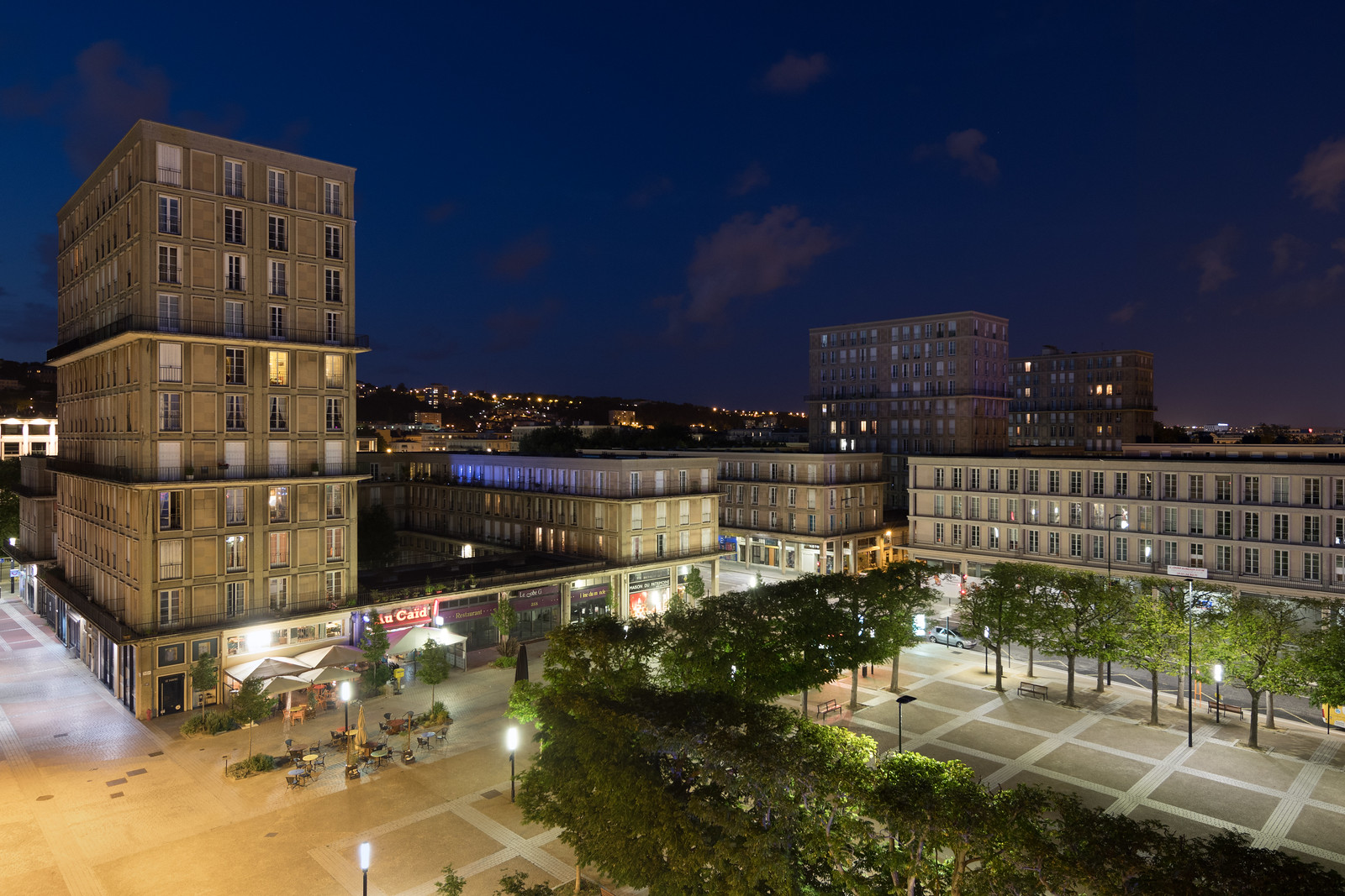
Modernism and a 500 Year Anniversary in Le Havre, France
Mixed-use buildings with residential towers overlooking Place Auguste Perret A modernist city designed by Le Corbusier’s mentor, Auguste Perret, sits on the coast of Normandy. Le Havre’s concrete origins date to September 1944, when the British bombed the German-occupied city’s coastal plain. The assault almost completely destroyed the district and killed more than 5,000 people.…
-
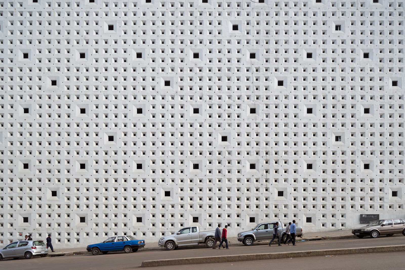
Ethiopian Concrete
One of the things I was most excited about for my visit to Ethiopia with Brian Ashby and Susannah Ribstein was the opportunity to see its modernist buildings. The thing was, I didn’t really know what we would see. African modernist architecture is chronicled in books like African Modernism: The Architecture of Independence or celebrated…