Category: Text
-
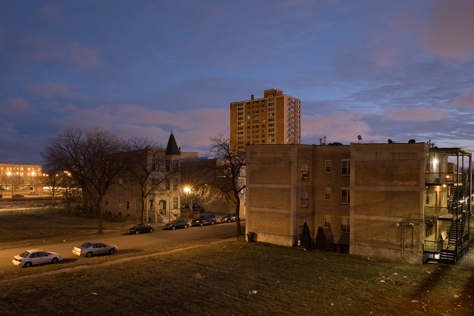
The 2017 Triangle
After a string of years bouncing around the map, in 2017 I mainly traced the triangle between Minneapolis, Chicago, and France. I spent most of my time teaching at St. Olaf and wrapping up The Area in Chicago, but I dedicated nearly two months to two different French projects. In January, I continued my “Resilient…
-
2016 in Review: Nearly As Much There As Here
2016 was another year of travel, but unlike previous years, my explorations were more international than domestic: for more than two months I made work in Belgium, Ethiopia, France, Ireland, Japan, Northern Ireland, and the United Arab Emirates. One month of that period was for a residency in the North of France and Belgium. The…
-
Rebuilding from the 2011 Tohoku, Japan Disaster
The distinctive rebuilding of the Sendai coast When Yohei Morita and I visited Tōhoku, Japan in 2014, I was most affected by the areas decimated by the tsunami — but it wasn’t for the reasons one might imagine. With the exception of the cities still in the radiation exclusion zone, most of the quarters destroyed…
-
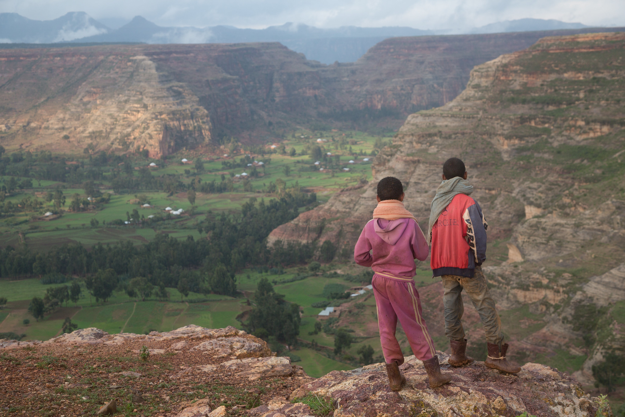
The Battle Between Ethiopian Boys and Monkeys
The cliffs and plateaus of the Agame massif. One of the unexpected experiences of my trip to Ethiopia’s Tigray region was witnessing the daily conflict between local boys and gelada monkeys. Endemic to Ethiopia, gelada monkeys are especially plentiful in the country’s central northern mountains. While some of these areas are protected “natural” lands, a…
-
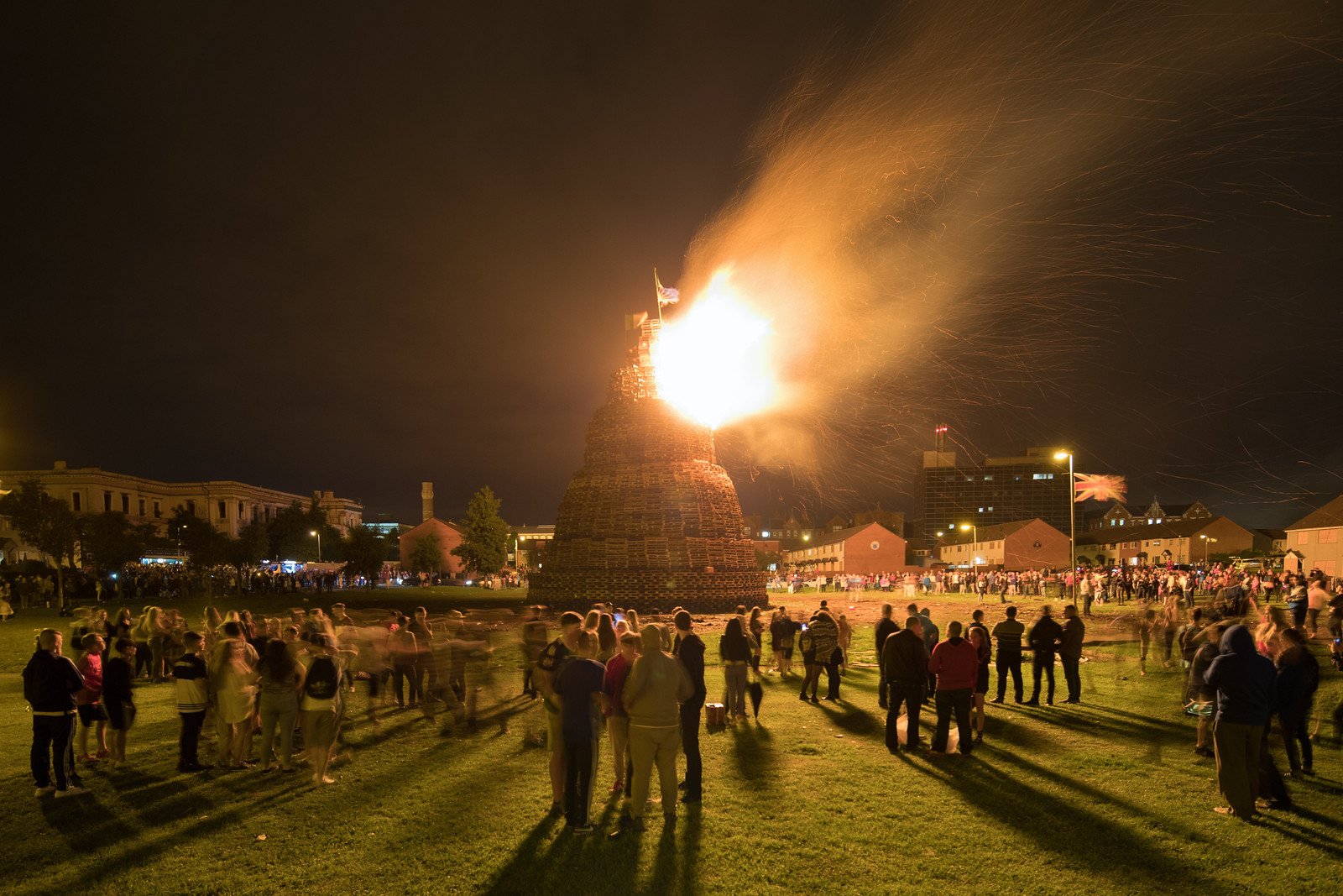
Bonfires and Brigades in Belfast
The main Shankill bonfire a few minutes after lighting. Six years ago, I started a project about two annual events in Belfast, Northern Ireland: the Loyalist bonfires of Eleventh Night and the Orange Order parades of The Twelfth. As I’ve described elsewhere, the related bonfires and parades are often discussed as cultural phenomena, but they…
-
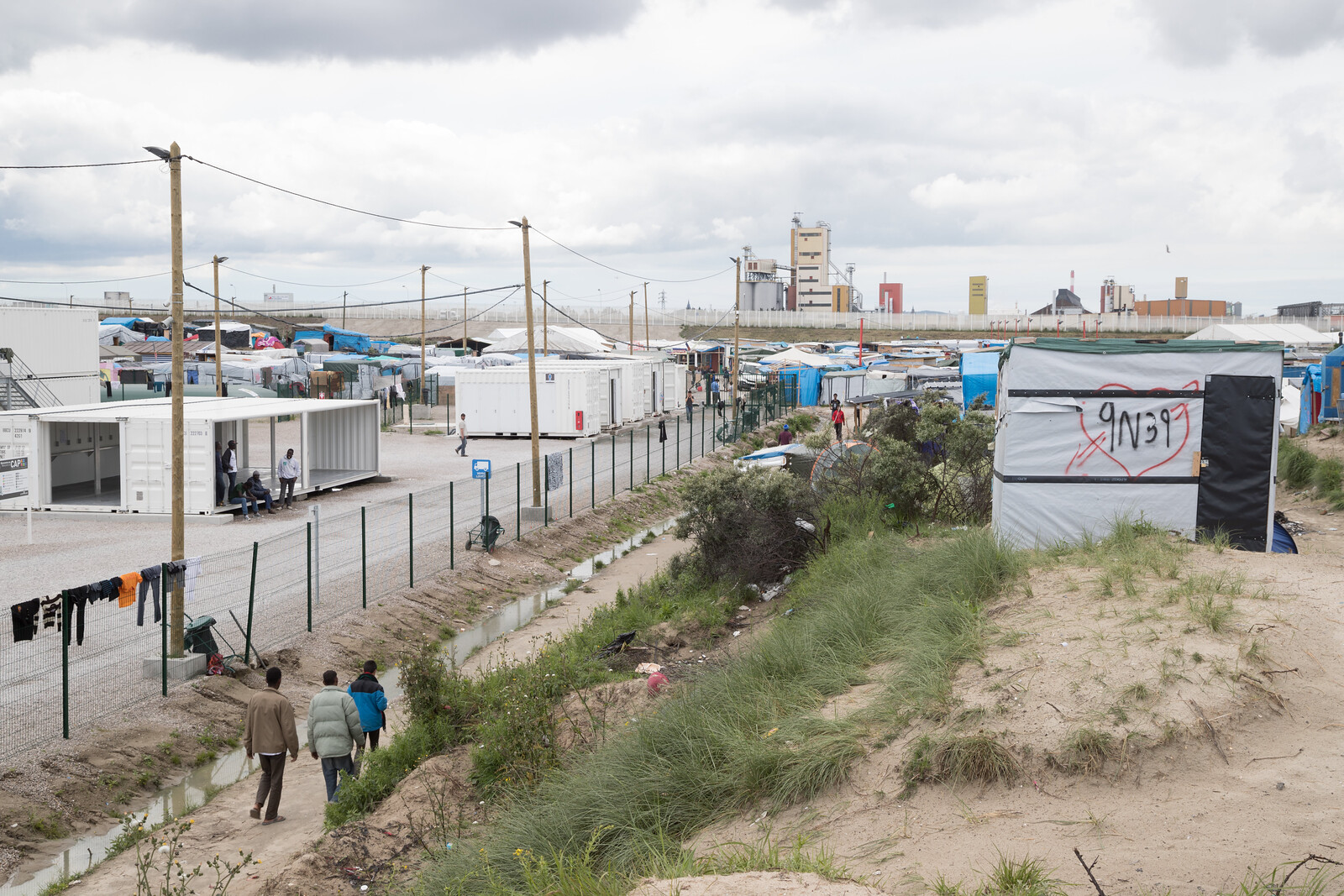
The “Jungle,” Border Conflict, and the Brexit
While the British were voting to leave the European Union I was across the Channel in the refugee camp known as the “Jungle.” Located in Calais, France, the informal camp is the last stop for immigrants hoping to enter England undetected via the Channel Tunnel. The camp and its 6,000+ residents have become a symbol…