The 2017 Triangle

The shuttered Hornaing, France coal-fired power plant.

After a string of years bouncing around the map, in 2017 I mainly traced the triangle between Minneapolis, Chicago, and France.

I spent most of my time teaching at St. Olaf and wrapping up The Area in Chicago, but I dedicated nearly two months to two different French projects. In January, I continued my “Resilient Images” residency in Hauts-de-France interpreting the character and identity of France’s former mining region. In August, I worked on a cultural heritage project in Paris, Hauts-de-France, and Normandy with Atout France. The next month, I returned to Hauts-de-France for talks, photography, and to open the residency show at the Centre régional de la photographie Hauts-de-France.

Back in the States, I showed a preview of my Resilient Images project at EXPO Chicago with the Hyde Park Art Center and then exhibited photographs from the Chicago Housing Authority’s Plan for Transformation at the Chicago Architecture Biennial and the National Public Housing Museum.

I did make time for a little other travel. I visited New York City twice with The Area to participate in the IFP Filmmaker Labs and briefly visited to southern California and central Indiana. At the end of the year I hopped back to Europe to hail the new year in Scandinavia. A good year.

I’m starting 2018 with the American debut of Hauts-de-France Mining Basin at the Hyde Park Art Center and “Urban Art and the Block: Film Screening of Selections from The Area.” In other projects, my book with Michael Carriere is closing in on a complete draft, and The Area should also be premiering soon — more about that shortly. Check the website or follow me on Twitter or Facebook for updates.

And now a few of my favorite photographs from 2017. Thanks for your interest, and Happy New Year!

Hauts-de-France Mining Basin and the Resilient Images Residency

With Terril

Flipping in the Former Coal Mine

Coal Car

See more from Hauts-de-France Mining Basin in my photography section of the website.

The Area Film

Review Screening of The Area at IFP in New York

Screening scenes from The Area at IFP’s Made in NY Media Center.

In the Area

Visit The Area‘s website for more information about the film.

Roubaix, France

Centre social Pile Sainte Elisabeth

Le Havre, France

Auguste Perret's St. Joseph's Church

Read more about Le Havre and Auguste Perret’s St. Joseph’s Church elsewhere on the blog.

Chicago, Illinois

On the South Side

Princeton, Minnesota

Teen Center

New York City, New York

On the Street

Solana Beach, California

And, Finally, By Moonlight

Jolietville, Indiana

A-Frame in Winter

Oslo, Norway

Frogner Apartments

Norefjell, Norway

Noresund Church

On Norefjell Mountain

Copenhagen, Denmark

Grundtvig's Church by Peder Vilhelm Jensen Klint

Grundtvig's Church by Peder Vilhelm Jensen Klint Grundtvig's Church by Peder Vilhelm Jensen Klint

New Years in Copenhagen

Modernism and a 500 Year Anniversary in Le Havre, France

Auguste Perret's Modernist Development
Mixed-use buildings with residential towers overlooking Place Auguste Perret

A modernist city designed by Le Corbusier’s mentor, Auguste Perret, sits on the coast of Normandy. Le Havre’s concrete origins date to September 1944, when the British bombed the German-occupied city’s coastal plain. The assault almost completely destroyed the district and killed more than 5,000 people.


Le Havre in January 1945
The commercial core of Le Havre in January 1945
(Image source: stitched panorama from the UNESCO Nomination, “Le Havre, the city rebuilt by Auguste Perret.”)

Rather than abandon the port city, the French government began planning for its reconstruction after liberation. From 1945 until 1964, the city’s core was totally reworked by a team assembled by Perret, yielding the singular city seen today. As with many modernist and brutalist developments, Le Havre fell out of favor towards the end of the 20th century before finding admirers in recent years. Perhaps the pinnacle of this recognition is the listing of the urban core as a UNESCO world heritage site in 2005. The designation recognizes the modernist area, with its standouts like Perret’s own Église Saint-Joseph and later structures like Oscar Niemeyer’s spectacular Maison de la Culture.

Now the city celebrates its concrete past and present, but this year it is also commemorating its 500th anniversary with more than a dozen art and architectural works installed as part of “A Summer in Le Havre.”

Earlier this month, I made a two-day visit to the city on behalf of Atout France and used my free time to visit some of the essential buildings of the reconstruction and the anniversary installations. I will publish additional images from the visit later, but these photographs are among my favorites.


Auguste Perret's St. Joseph's Church
Auguste Perret’s Église Saint-Joseph

Auguste Perret's St. Joseph's Church
Auguste Perret’s Église Saint-Joseph interior with Chiharu Shiota’s Accumulation of Power

Oscar Niemeyer's Maison de la Culture du Havre (Le Vulcan)
Oscar Niemeyer’s Maison de la Culture du Havre, now called “Le Vulcan”

Bibliothèque Oscar Niemeyer
Bibliothèque Oscar Niemeyer, originally the smaller theater from the Maison de la Culture du Havre complex

Oscar Niemeyer, Renovation by Sogno Architecture
Interior of Bibliothèque Oscar Niemeyer, renovation by Sogno Architecture

Auguste Perret's Le Havre City Hall Auguste Perret's Modernist Development
The Le Havre city hall tower and a mixed-use building with the Saturday market in the foreground

Auguste Perret's Apartment Building
Interior of a residential tower model apartment with period furniture

Auguste Perret's Modernist Development
Looking south down Rue de Paris towards Vincent Ganivet’s Catène de Containers

Vincent Ganivet's Shipping Container Sculpture
Vincent Ganivet’s Catène de Containers

Lang and Baumann's La Porte Océane
Lang and Baumann’s UP#3, La Porte Océane

In Her Cabana
A resident in her cabana with Karel Martens’ Colors on the Beach

In Their Cabana
In their cabana with Karel Martens’ Colors on the Beach

Le Havre Skate Park
The Le Havre Skate Park

Special thanks go to Eric Baudet and Atout France.

Ethiopian Concrete

A Mixed-Use Building

One of the things I was most excited about for my visit to Ethiopia with Brian Ashby and Susannah Ribstein was the opportunity to see its modernist buildings. The thing was, I didn’t really know what we would see.

African modernist architecture is chronicled in books like African Modernism: The Architecture of Independence or celebrated in international designations like UNESCO “World Heritage” status for the Eritrean city of Asmara; however, those projects don’t represent Ethiopia. When Ethiopian architecture is referenced, it is typically about its spectacular monolithic churches or the most monumental buildings of the modernist period, like Arturo Mezzedimi’s Africa Hall and Addis Ababa City Hall.

Bete Giyorgis
The late 12th or early 13th century monolithic church Bete Giyorgis in Lalibela

But modernist concrete is everywhere in Ethiopia. During the late 1950s and early 1960s, when many other African states were asserting independence from their colonists, Ethiopian Emperor Haile Selassie was conceptualizing how to assert Ethiopian modernity through architecture and urban planning. With a vision shared by many other African elites, he worked with European, American, and African architects to augment the dominant International Style with local characteristics.

The marquee buildings are interesting, but I was more intrigued by the smaller buildings scattered throughout Addis Ababa. The following photographs are a sample of the modernist and brutalist buildings we saw strolling through the city during the rainy season. A note about and a few photos of contemporary architecture follow the set.

Mezzedimi's Zauditu Building
Mezzedimi’s Zauditu building

A Crown

A Mixed-Use Building

A Mixed-Use Building

SHOA
From the traffic circle

SHOA, Second View
A second view

John F. Kennedy Library at Addis Ababa University

Kobil Service Station and Apartments

Modern Building

With Central Stairwell

Bedilu Hintsa
Bedilu Hintsa

Today, Addis Ababa is a construction site. The Ethiopian government is displacing thousands of residents and clearing large portions of the city in order to “modernize” the “slums.” New buildings for new people and businesses are replacing those areas, and shoddy low-rise “condominiums” are being built on the edges of the city to house the displaced and others.

In the context of this calamity, the occasional building is rising to serve social functions with spectacular design, like Vilalta Arquitectura’s Lideta Market. I wish we’d had more time to see other examples and better understand the entire situation.


New construction
New construction in Geja Sefer

Under Construction
New construction along Airport Road

CU9I9159
New condominium construction

From the Light Rail
A modernist mixed-use building dwarfed by new construction

Vilalta Arquitectura's Lideta Market
A detail of the Lideta Market

Vilalta Arquitectura's Lideta Market
The Lideta Market

Special thanks to Zacharias Abubeker and Marjan Kloosterboer.

2016 in Review: Nearly As Much There As Here

2016 was another year of travel, but unlike previous years, my explorations were more international than domestic: for more than two months I made work in Belgium, Ethiopia, France, Ireland, Japan, Northern Ireland, and the United Arab Emirates.

One month of that period was for a residency in the North of France and Belgium. The residency, “Resilient Images,” is a joint program launched by the Hyde Park Art Center and the Centre régional de la photographie Nord—Pas-de-Calais and supported by the MacArthur Foundation, the French Embassy, and Institut Français. I will be writing more about my project in a few months, but if you’re interested in learning a little more about what I’m doing in the North, you can read a little more about it in this short interview. The rest of the summer, I continued my project about Eleventh Night and the Twelfth in Belfast, photographed in Tōhoku and showed photographs at Gallery Tanto Tempo in Japan, toured Ethiopia with friends, and visited with guest workers in Dubai.

But I also did some domestic travel, including for a show in Buffalo, New York at Dennis Maher’s incomparable Fargo House and a screening of scenes from The Area at the University of Wisconsin Milwaukee’s Mobile Design Box in Milwaukee, Wisconsin. I also made brief visits to the area around Louisville, Kentucky and New Orleans, Louisiana. Of course, I spent plenty of time in Chicago, Illinois and Minneapolis, Minnesota, which finally feels like home.

The other big project news is that after nearly five years, The Area is swiftly moving towards completion with Scrappers Film Group after a party and fundraiser in December. “Thank you,” everyone who attended and contributed!

I can’t possibly do justice to the places I visited in this short post, but I’ve included links to locations for which I made blog posts, and posted a few photographs from each site. If I authored a blog post about a particular visit, the section title is a link to the post.

To 2017! It’s going to be a busy one, isn’t it?

Resilient Images Residency in Hauts-de-France, France

Watching, Power Plant
Residents calling for their dog from their street.

Gathering to Depart
ATV riders gather to move from one part of a slag heap to another.


Coal cars displayed in former mining towns.

Belgium

Playing Soccer in Molenbeek
Young immigrants play soccer in Brussels’ Molenbeek neighborhood.

Belfast, Northern Ireland

Igniting the Children's Bonfire
Shankill neighborhood residents ignite their children’s bonfire.

Tōhoku, Japan

CU9I4862 Update
Post-tsunami and radiation contamination remediation in downtown Tomioka.

The “Jungle,” Calais, France

CU9I9467
The formal and informal Calais “Jungle” camps before demolition.

Ethiopia

IMG_5846
Two boys look down to their village in rural Tigray.

CU9I8533 CU9I8127c
A minibus stop and an outdoor pool hall in Addis Ababa.

CU9l1760_8
The Church of St. George in Lalibela.

Dubai, United Arab Emirates

CU9l6493_87
Scrappers remove kitchen counters from a partially demolished house.

Trucks
A small sample of the variety of modified truck designs in sand parking lots.

CU9I6215-2 CU9I5940
Two Pakistani guest workers and the largest Tim Horton’s advertisement I’ve ever seen.

Buffalo, New York

Buffalo Telescope Houses
Six new telescope house photographs I made while visiting for my exhibition.

Chicago, Illinois

IMG_8928
The beginning of the Scrappers Film Group party and fundraiser for The Area at Lost Arts.

Leaning
A leaning, isolated building near the former United States Steel South Works site.

Louisville, Kentucky

Overlooking the Ohio River
Overlooking the Ohio River and Louisville, Kentucky from Jeffersonville, Indiana.

Milwaukee, Wisconsin

IMG_3585
A major clean-up effort in a North Side neighborhood.

Minneapolis, Minnesota

CU9I7320
The Minnehaha Free Space before it was displaced by a new landlord.

IMG_7796
A former entry area of the Minneapolis Scottish Rite Temple.

New Orleans, Louisiana

IMG_8271c
Four teenagers posing outside a corner store in the Lower Ninth Ward.

Rural Minnesota

National Farmer's Bank of Owatonna
Louis Sullivan’s National Farmer's Bank of Owatonna.

Rural Wisconsin

Woodside Place
A former church in St. Croix.

Rebuilding from the 2011 Tohoku, Japan Disaster


CU9I3402
The distinctive rebuilding of the Sendai coast

When Yohei Morita and I visited Tōhoku, Japan in 2014, I was most affected by the areas decimated by the tsunami — but it wasn’t for the reasons one might imagine. With the exception of the cities still in the radiation exclusion zone, most of the quarters destroyed by the tsunami had already been cleared by the Japanese government. In these places, there were few overturned cars, thrashed buildings, derelict streets, or even memorials. With few exceptions, they were remarkably sterile places, with scant clues that the areas had ever been inhabited, not to mention inhabited and then obliterated.

The occasional signs of mayhem, like the gleaming new headstones that filled nearby cemeteries, were amplified by this context, but my main reaction was still to what wasn’t there. I was affected because I couldn’t comprehend what we were witnessing. I wasn’t prepared for this kind of devastation and response.

So when Tanto Tempo Gallery invited me to return to Japan this summer, I set aside half of the trip to revisit Tōhoku to see what had changed and to experience how my understanding of it might change too. My approach would be twofold: to match photographs I made in 2014 and to seek out new areas, particularly revitalization projects.

I will keep the text relatively short, but I should make a few notes before I get into the first set of images. An enormous amount of effort put into the region: nearly all of the towns are cleared, harbors have been reconstructed, flood walls are everywhere, new housing has been built, and people have initiated creative community building up and down the coast. Even so, my main reaction to the place remains: I can’t help but be awed by the openness of coves, the emptiness of places I know were once inhabited, and those shining cemeteries.

CU9I3707
A gate above Ishinomaki

CU9I3714 Update
Demolition and construction preparations along the city’s coast

In 2014, Yohei and I spent time with the community activists behind Space for Community, a local advocacy organization and meeting place in Ishinomaki city. After that experience, I knew I’d want to make Ishinomaki a focal point of this trip. I wasn’t able to meet with Space for Community this time around, but I visited with a number of Ishinomaki groups, including Ishinomaki Laboratory, a community-based woodworking shop. There I met with Warafuji, Takahiro Chiba, and David Wang, with whom I discussed the group’s founding, products, and future.

The organization is an hybrid community organization, essentially local but with inspiration and assistance from Tokyo-based designers. Founded in response to the disaster, the group creates and builds furniture with a straightforward, DIY design language. It is also currently strengthening a partnership with a local women’s weaving group to expand their small line of textiles. Their products are not yet available in North America but are available in Asia and Europe.


CU9I3834 CU9I3854
CU9I3836 CU9I3844
Warafuji and Takahiro Chiba in the Ishinomaki Lab workshop, some of their small wooden and textile products

After leaving Ishinomaki Lab, I took David Wang’s recommendation and headed to Hashidori Common for a meal. The food truck-like establishment was launched to provide opportunities for small restauranteurs to build their businesses while simultaneously creating an informal town square. Even on a rainy night, a dozen people were eating in the semi-covered dining areas.


CU9I3975
A customer places her order in Hashidori Common

Other than this time in Ishinomaki, most of my visit wasn’t in the town centers but retracing Yohei’s and my previous route through the costal towns and coves. I did make some new compositions during this part of the trip, but I focused on rephotographing the scenes, matching images from 2014. In these areas progress is both monumental and surprisingly slow.


CU9I4333 Update
Minor construction work continues along the Ogatsucho Mizuhama port

CU9I4458
New housing is under construction in the hills above Ogatsucho Mizuhama

CU9I4091 Update
The temporary memorial outside Okawa Elementary School has expanded

CU9I3533 Update
Tsunami damaged railroad tracks in Higashimatsushima have been removed

CU9I4068 Update
Activity continues in some places along the Kitakami River, if with reduced intensity

CU9I3588
In other locations, construction — particularly flood protection — is as active as ever

CU9I4051 Update
Elsewhere, infrastructure development (and hill removal) along the Kitakami River is nearly finished

CU9I3552 Update
I was surprised by the construction of a new (elevated) home in Higashimatsushima

CU9I4259 Update
The Christmas tree and memorial in Ogatsucho Kamiogatsu were long gone

CU9I4284
Some infrastructure had an otherworldly feel

CU9I3452
New context had sprouted around some cemeteries, like this skatepark in Sendai

While the emergent theme of the first half of the Tōhoku trip was rebuilding, driving south to the radiation affected area changed the tone. With each mile, the landscape appeared increasingly like my 2014 visit, although with warnings about radiation (and that nagging feeling about whether or not I should really travel into the former exclusion zone).

I was driving to Tomioka, a radiation-blanketed town Yohei and I visited with Deputy Mayor Hirofumi Sanpei. This time I would do the visit alone. While Yohei and I needed to be officially cleared and accompanied to visit in 2014, much had changed in the two and a half years, including that the town’s radiation levels have been partially remediated. As a result, the town is open for some redevelopment. Construction workers move relatively easily, and residents may return to some areas on a limited basis. I wouldn’t need to pass through security checkpoints before entering an exclusion zone, although I was stopped and questioned by the police during the visit.

The newfound opening of the city did not affect much of National Route 6, which — while open — was flanked by temporary gates preventing access to houses and businesses along the road and radiation monitors. Each provided tangible reminders of the area’s invisible contamination.


CU9I4786 CU9I4779
Temporary gates and a radiation monitor along National Route 6, the Rikuzenhama Highway

CU9I4729
Bags of contaminated soil along National Route 6

Because I wasn’t with Deputy Mayor Sanpei, I was unable to revisit a portion of the town we visited in 2014, but I was able to see the majority of the town center. Arriving near the old train station, I freely moved among cleanup crews along streets once surrounded by buildings. The area had been cleared of structures, leaving only the streets, a few utility poles, and the hills to remind visitors of what was once there. An occasional dignitary would arrive accompanied by staffers only to take a few photographs with a cellphone and then duck into a waiting car. I was surprised by how the area was both empty and busy.


CU9I4862 Update
The most visible signs of tsunami damage have been removed from downtown Tomioka

CU9I4934 Update
… including the downtown Tomioka storefront with the clock stopped at the time the earthquake struck

CU9I4821 CU9I4867
Workers cleared soil while visitors snapped photographs of the obscured coastline

CU9I4856 Update
The site of the former Tomioka train station is being reworked

CU9I4927 Update
A few buildings were visible away from downtown

CU9I4898 Update
Trucks drove where buildings once stood

The concentrated nature of the cleanup effort was clear in the city’s residential neighborhoods, where the streets were near motionless. Along these streets, dereliction is rampant and there are few visible workers. The occasional building has even collapsed in on itself. Here, I regularly stopped my car in the middle of the street to stand on the sills and get a slightly elevated view of the blocks.

After 30 minutes of driving through these neighborhoods I hit the edge of the former exclusion zone and began my long return trip to Tokyo.


CU9I4957 CU9I5025
CU9I5026 CU9I5007
Four quiet Tomioka streets

CU9I4987
Derelict buildings in Tomioka

I expected that this visit would be just the second of many trips to Tōhoku, but I was surprised by how much had — and hadn’t — changed in two and a half years. Some of the modifications are masked by the tension between tangible and intangible changes, but the continued need for infrastructure development and residential cleanup makes me especially curious about the region’s future. I left Tōhoku more energized than haunted, and I can’t wait to return.

The Battle Between Ethiopian Boys and Monkeys


CU9I0613
The cliffs and plateaus of the Agame massif.

One of the unexpected experiences of my trip to Ethiopia’s Tigray region was witnessing the daily conflict between local boys and gelada monkeys.

Endemic to Ethiopia, gelada monkeys are especially plentiful in the country’s central northern mountains. While some of these areas are protected “natural” lands, a significant portion of the habitat is primarily agricultural. I visited one such area with Brian Ashby and Susannah Ribstein: the Erar community of Tigray’s Agame mountains. In the massif, plateaus are cultivated for barley, chickpeas, lentils, linseed, wheat, and other crops. Because geladas are scavengers, the monkeys often take advantage of these fields and their easy nutrition.

As one might expect, the farmers aren’t thrilled by the monkeys eating their crops. The solution is hiring local boys to protect the fields. From dawn to dusk, the boys scan the plateau for gelada harems who might raid the crops and then scare the monkeys away. In exchange, the boys will be paid 5kg of the crops raised by each farmer in their territory. For example, one of the three boys with a domain on the small plateau we visited took home 5kgs of linseed, lentils, barley, and wheat last year.

The following photographs are a glimpse of the back and forth between the monkeys and boys.

Special thanks to Kiros Zeray for the background and translation.


CU9I0686
Geladas climb the cliff to access one of the fields on the plateau.

CU9I0898
Once up top, the geladas eat the crops — in this case, small sprouts and seeds.

IMG_5803
One boy surveys his territory from a self-built stone pedestal.

IMG_5885 IMG_5904
The boys also patrol with slingshots and scan the cliff edges.

CU9I0708.00_00_13_14.Still001c copy
When the boys see the geladas, they yell and hurl rocks at the monkeys, chasing them to the cliff edges.

CU9I0884
The monkeys retreat below the plateau.

CU9I0866
Some of the monkeys continue to taunt the boys from the ledge. The valley floor may be as much as 500 meters below.

IMG_5869
Because the geladas don’t venture into the fields in the dark, the boys relax once the monkeys settle into their cliffside caves for the evening.

IMG_5846
Two of the boys look down to their village before returning for the night. They and the monkeys will return in the morning.

Bonfires and Brigades in Belfast

The Shankill Bonfire
The main Shankill bonfire a few minutes after lighting.

Six years ago, I started a project about two annual events in Belfast, Northern Ireland: the Loyalist bonfires of Eleventh Night and the Orange Order parades of The Twelfth. As I’ve described elsewhere, the related bonfires and parades are often discussed as cultural phenomena, but they are also political affairs intended to reinforce the United Kingdom’s claim over Northern Ireland.

This political character is obvious in the Loyalists’ burning of the Irish tricolor, Sinn Féin election posters, and even Irish soccer team jerseys, but the partisan nature of the bonfires was even clearer this year. Support for the Brexit and disparagement of the European Union abounded, and local political developments related to the bonfires were also referenced. The most direct local example was the burning of election posters for SDLP Councillor Claire Hanna, who champions reigning in the bonfires.

But counterbalancing also occurred: the “beacon” program I referenced in 2012 continued to operate as an environmentally friendly alternative to bonfire construction, and the bonfire and parade events appeared to be changing. Many bonfires were more subdued than before, numerous participants seemed more interested in spectacle than politics, and the city felt less tense than in recent years. The Police Service Northern Ireland was certainly out in full force, but they weren’t needed in the typical way. This was even true for the Twelfth parade routes where riots have occurred during my previous visits.

More detailed background about the situation and selected photographs from my Belfast series are available in main website gallery, which I’ll be updating soon. In the meantime, favorite photographs from this year’s trip are below.


Brexit
Britain’s recent vote to leave the European Union was celebrated on the Tigers Bay bonfire. The Ulster Defense Association‘s shield is displayed above the “Brexit” sign.

Union Jack Haircut Posing for a Picture
A boy sports a Union Jack haircut, while another poses for a picture before helping ignite a bonfire.

Culture Threatens
While the Union Jack and Ulster Banner will be removed before the bonfire is lit, the Sinn Féin election posters will not.

Another Bonfire Another Bonfire
Installing Tricolors At Night
Four bonfires.

Igniting the Children's Bonfire
Belfast’s extended twilight makes for some spectacular scenes. This children’s bonfire is dressed with two Irish tricolors, the European Union flag, the Isis flag, and a jersey from the Celtic Football Club.

Socializing at the Children's Bonfire Socializing
Socializing at the bonfires.

Embers
A shower of embers from the Shankill bonfire.

Row House Burning
Despite boarding up windows and doors to protect houses from the Shankill bonfire’s spectacular embers, the roof of a nearby row house ignited, destroying multiple units. This is the moment the first roof collapsed.

At the Smoldering Pile
Young band members visit the smoldering remains of the Shankill bonfire before parading through the city. The damaged row houses are in the background.

Marching Past the Clifton Street Orange Hall
Marching past the Clifton Street Orange Hall.

Watching the Parade Marching
In a Cage During the Parades
Some watch the parade, others participate.

Resolution is Possible
Residents protest a parade route that skirts a Catholic neighborhood.

Cleaning Up the After the Bonfire
Cleaning up the after the bonfires requires multiple work crews operating over several days. This team is taking a first pass at a site near the city center.

The “Jungle,” Border Conflict, and the Brexit

CU9I9467

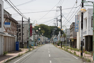
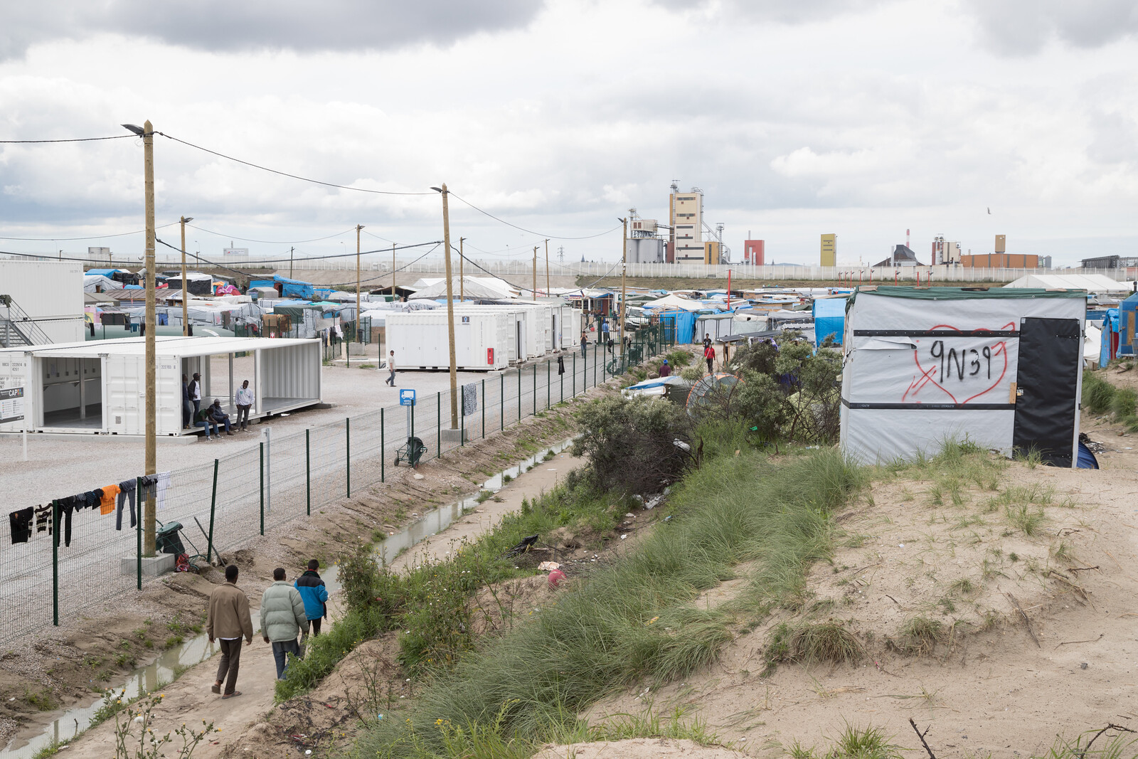
While the British were voting to leave the European Union I was across the Channel in the refugee camp known as the “Jungle.” Located in Calais, France, the informal camp is the last stop for immigrants hoping to enter England undetected via the Channel Tunnel.

The camp and its 6,000+ residents have become a symbol of for Britain’s changing relationship with Europe and its former colonies, not to mention the demographic changes and refugee crises that seem to be so important for those who support Britain leaving the E.U.

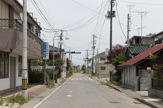
During the time the “Jungle’s” representation has been central to such political conflicts, the camp itself has taken a number of forms. It continues to increase in size, but its most dramatic changes have been relatively recent, particularly the demolition of a 100-meter wide section of the camp that abutted an elevated highway and the construction of a new formal aid center inside the informal camp. Other changes include the establishment of a nearby site that offers additional security for women and children apart from the male dominated main camp.


One short note before I continue to the main text: I include photographs in the post, but I only photographed for a small portion of the time I was at the camp. When I did photograph, I always asked for permission first and intentionally avoided close-up photographs in most cases. Additionally, I’ve only included the names of a couple of residents and volunteers who are publicly known. This is to protect the privacy of the refugees, many of whom are understandably concerned about broadcasting their temporary association with the camp, particularly given their desire to enter England as undocumented immigrants. This also goes for volunteers, who have their own concerns about attacks from nationalist groups and persecution (and prosecution) by the police for their activities, which are not always appreciated by authorities.


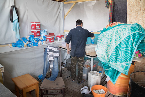
I was able to visit the camp with the refugee relief organization L’Auberge des Migrants, which distributes clothing and other essentials to residents. The organization coordinates its activities in a warehouse that is a short drive from the camp. Their grounds house a donation sorting center, the food relief organization Refugee Community Kitchen, and “Caravanarnia,” a camp for volunteers who wish to stay at the warehouse.


L'Auberge des Migrants
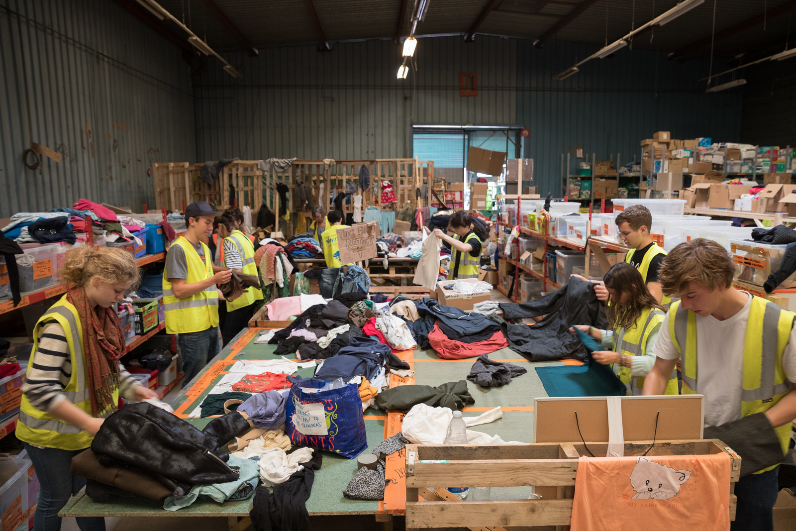
L’Auberge des Migrants volunteers sorting clothing.

Refugee Community Kitchen
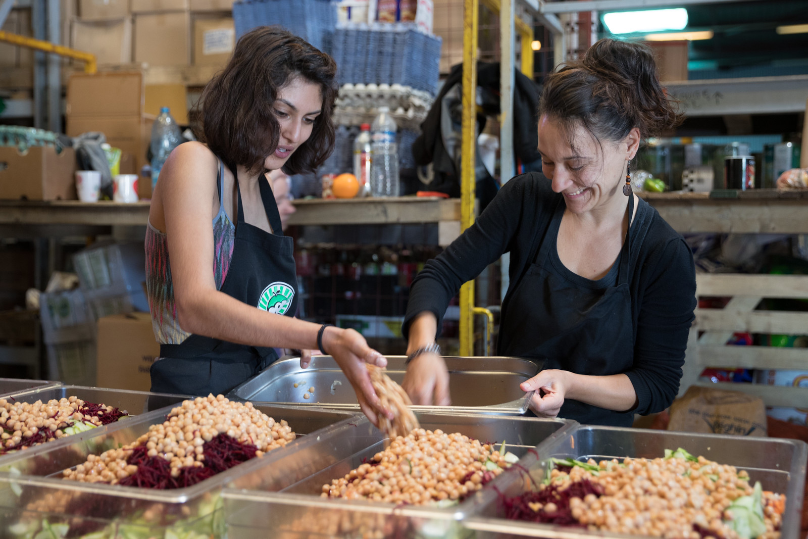
Refugee Community Kitchen volunteers preparing the day’s salad.

My visit to the “Jungle” started with an introduction from Maya Konforti, one of the leaders of the organization. Konforti has been working in the camp since its infancy, and walking through its streets yields a near constant stream of greetings, hugs, and calls of “Mama!” as she passes.

Among those Konforti and I visited was an Afghan immigrant named Sikander, who founded Jungle Books Kids’ Restaurant with his English partner Mary Jones. Sikander gradually created the first restaurant in the camp while selling food to people who stayed with him. After running a couple of small restaurants in the first portion of the Jungle that was demolished by authorities, the pair was distressed by the conditions endured by the camp’s 700 minors, of which nearly 80% are unaccompanied in Calais. In response, they created a place where the camp’s young residents can hang out, eat, learn, and keep out of trouble in a camp teeming with drugs and other threats.


Boys Playing Billiards

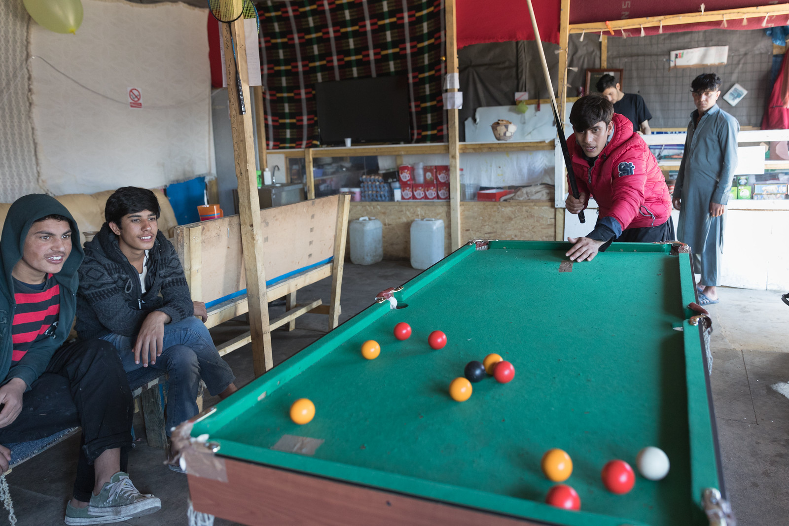
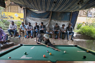
Teenagers playing billiards at Jungle Books.

Sikander and Maya Konforti

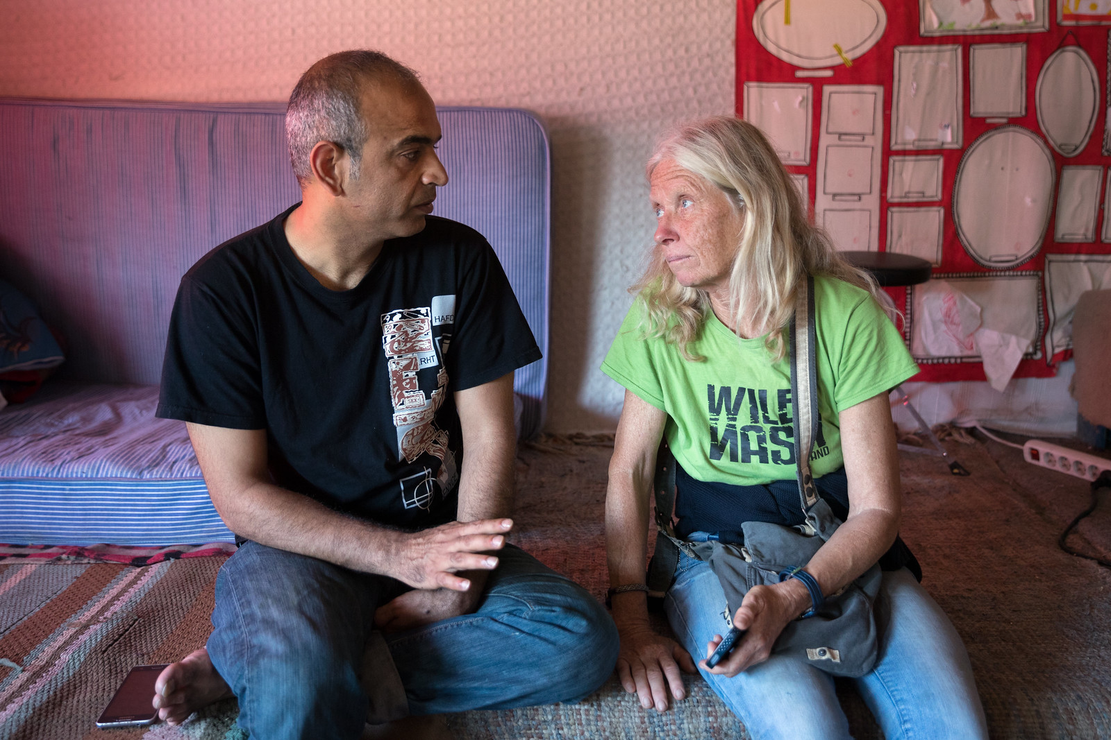
Sikander and Maya Konforti talking in the center.

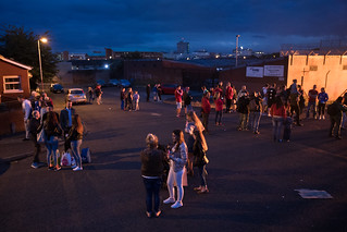
After Konforti and I parted for the afternoon, I wandered the camp, meeting refugees from Afghanistan, Eritrea, Ethiopia, Pakistan, Somalia, and Sudan, and spending time in restaurants, shops, and the occasional home. When people learned I was American, they always asked about American politics, particularly about Donald Trump’s candidacy and his public support. Invariably, conversation drifted to immigration policy in the U.S. and then to the Brexit. What would it all mean for the refugees?


CU9I9532 CU9I9551

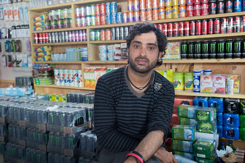
The friend of a shop owner watches his store, and a baker prepares naan.

On a few occasions, a passing resident would see my camera and say some variant of “We need a solution,” which meant that they were tired of the media attention with no change to immigration policy or conditions in the camp. I agreed with them, and we’d have a discussion about the entire situation, but it was just another conversation…


London Bread Khan'Shop
Khans Sunshine Ethiopian Restaurant
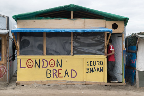
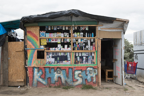
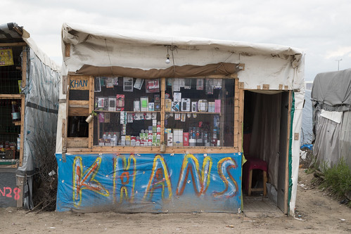
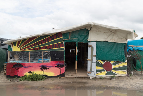
A few of the restaurants and shops on the main street.

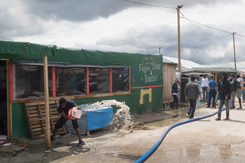
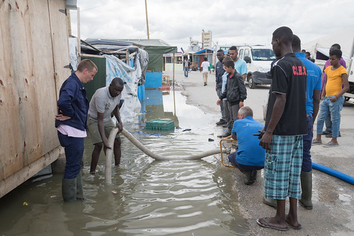
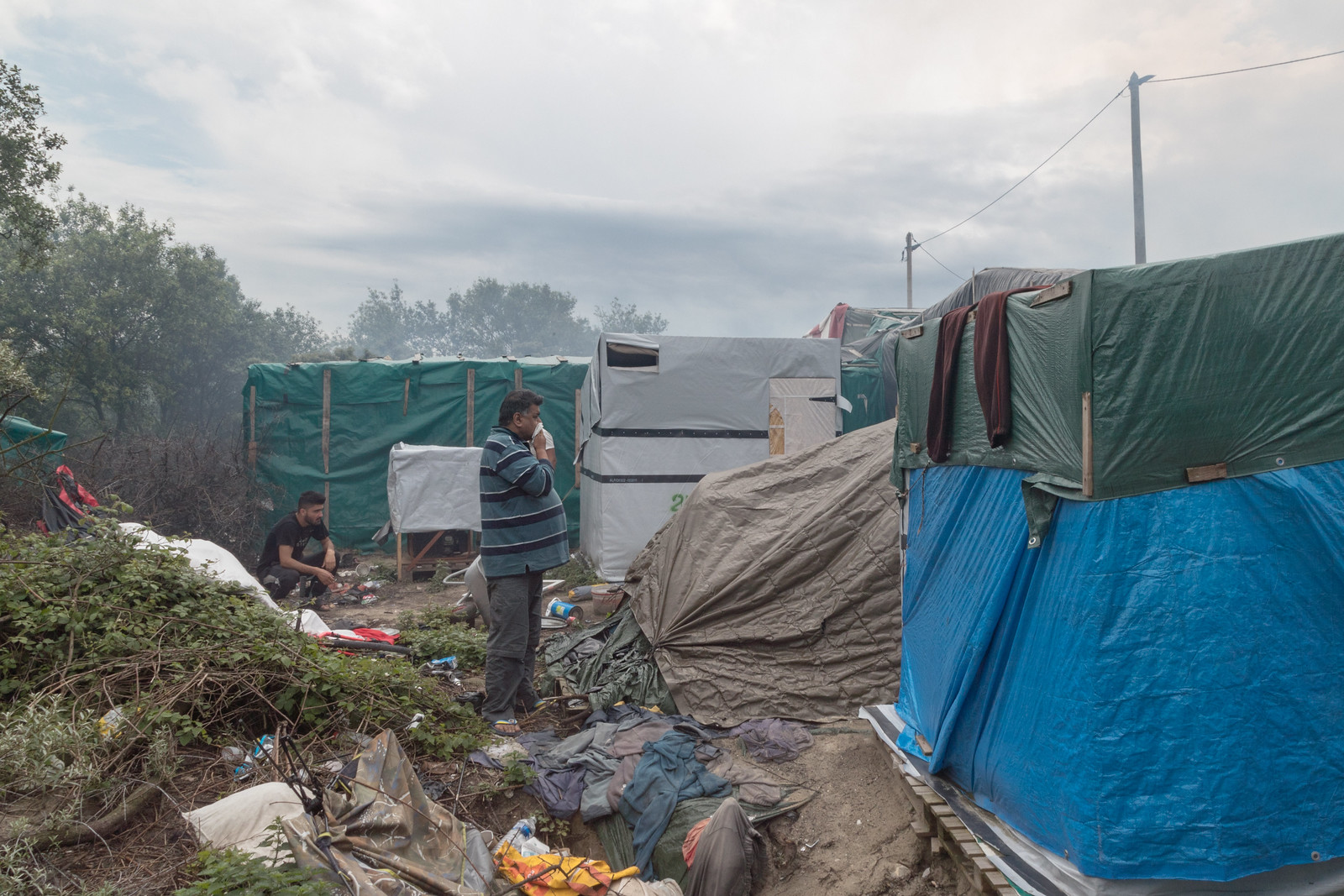
It stormed the night before, so there was standing water everywhere, and people were drying out the belongings of their tents. Many streets and paths were flooded; some were being cleared.


Clearing Water Clearing Water

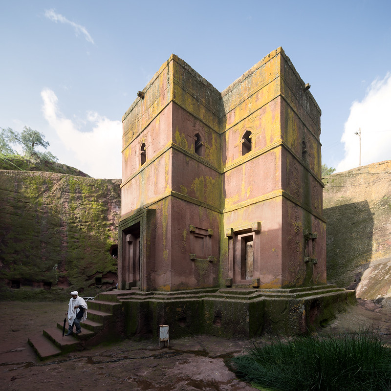
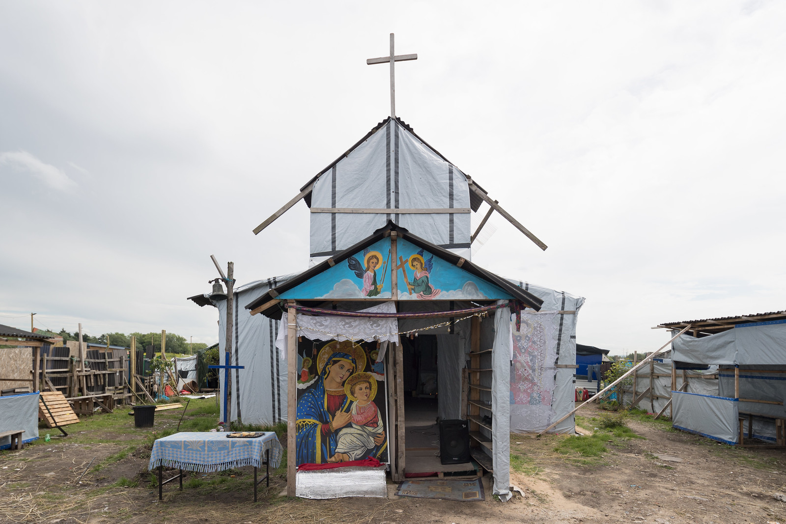
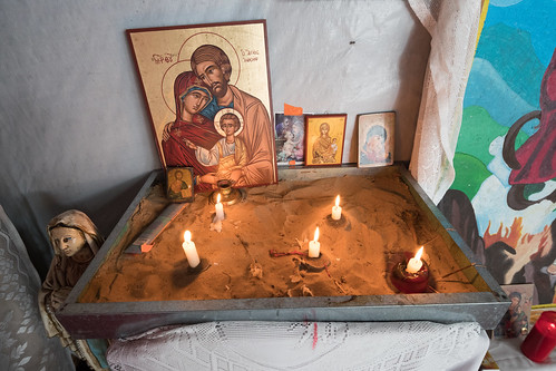
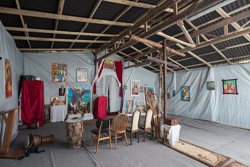
Since I’d read about the large Ethiopian church spared from demolition a few months earlier, I decided to leave the main camp area and walk down the pathway to the church. I waited until the residents in the church were done praying, then took off my shoes and entered the church.


The Church

The Church The Church

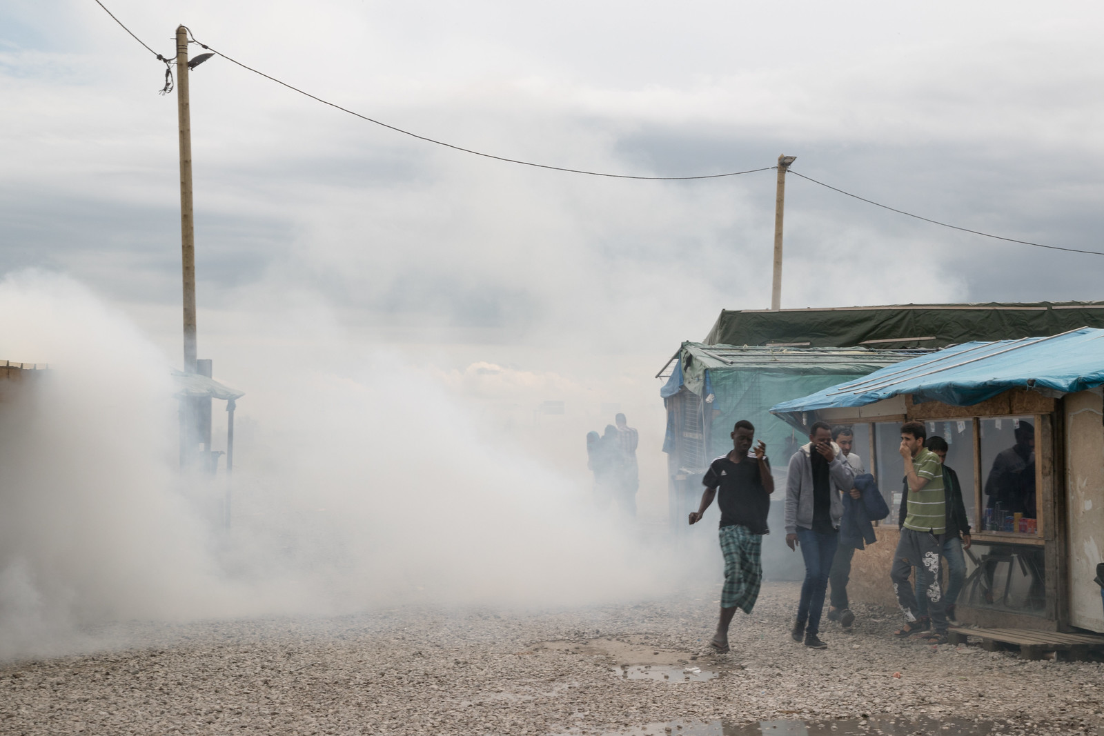
Within a few minutes of being inside, I heard the dull sound of projectiles firing in the distance and then bustling around the church. I put on my shoes and walked out of the church courtyard to see tear gas lingering by the entrance to the camp and residents fleeing the area. One of the Pakistani residents with whom I’d recently spoken pointed out the problem areas.

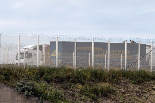
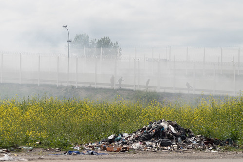
Minutes before, a number of refugees tried to climb on top of stopped semi-trailer trucks on the highway in hopes of riding them into the trains that traverse the tunnel. The police fired tear gas in an attempt to get the refugees off the highway and then keep them out of the 100 meter zone. While some residents retreated, the commotion enlarged the crowd, which was in the hundreds by the time I made it down to the area.


Refugees Atop a Truck Fleeing Tear Gas
Residents on top of a semi-trailer truck and fleeing the tear gas on the highway.

Firing Tear Gas
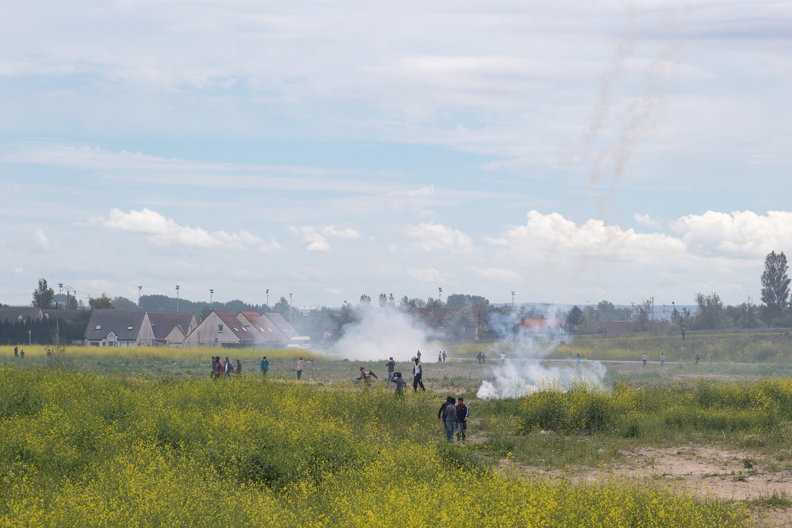
The police firing tear gas into the 100 meter exclusion zone.

Camp Residents Overlooking the Zone
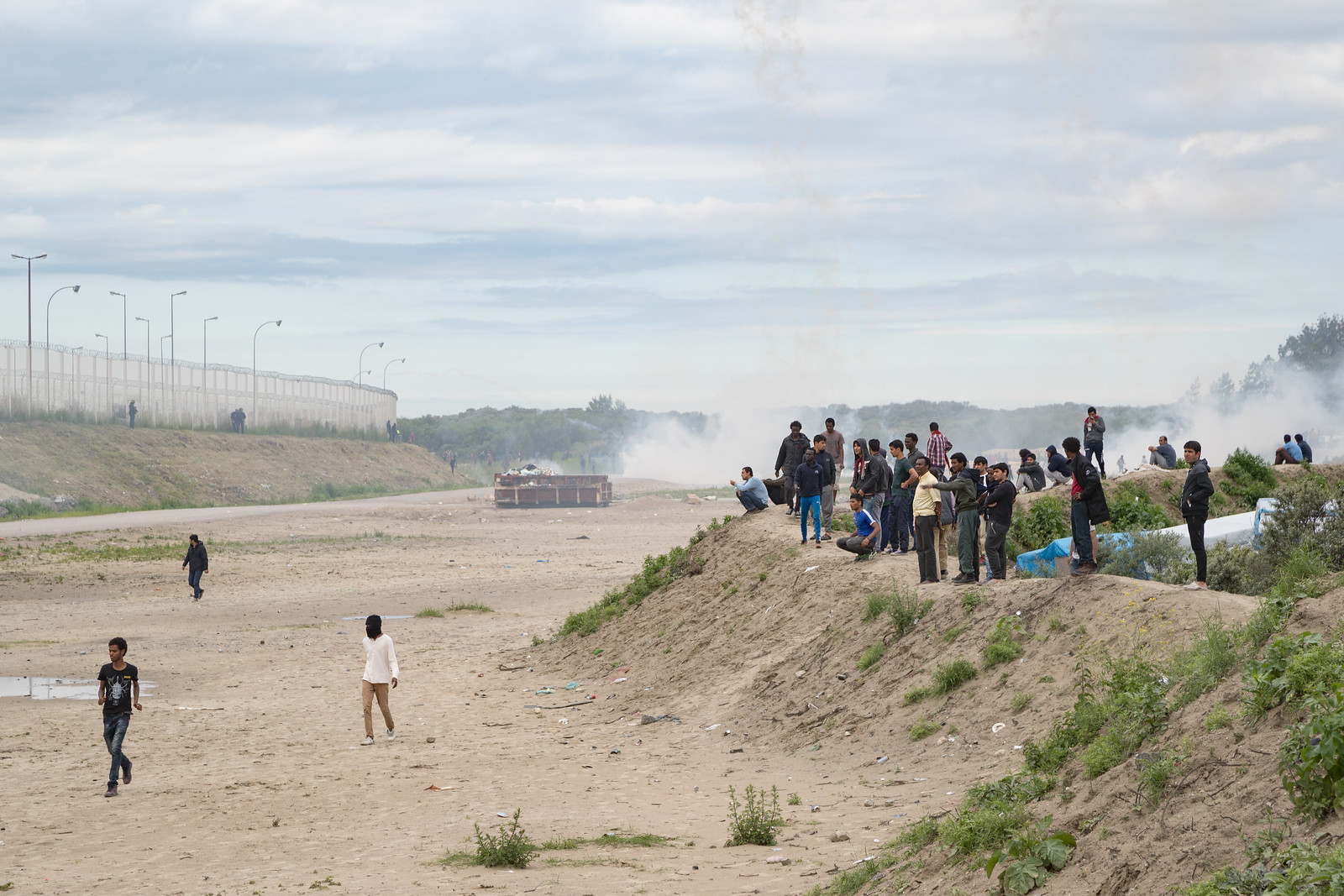
Camp residents standing on the embankment overlooking the highway and exclusion zone.

After standing on the embankment for a few minutes watching the tear gas get launched elsewhere and the police corralling some demonstrators, one young resident in his late teens picked up a rock from the area behind the ridge on which most residents were standing. A few people looked back at him and urged him “No, no, no!” After pausing for a few moments, he hurled the rock over the crowd. The rock didn’t land near the police but they quickly turned, directed their tear gas at the ridge and fired their canisters.


Police Guarding the Highway Police Threatening Refugees
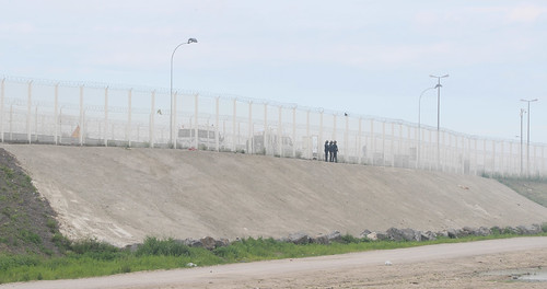
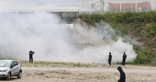
Police guarding the highway and threatening refugees getting too close to the tear gas canisters.

Everyone on the mound scrambled down to the walls of the small buildings that define the edge of the camp, seeking a way to squeeze between structures and make their way deeper into the camp.

Fleeing the Tear Gas

I found a way through a couple of makeshift buildings and ended up on the main street. The gas tumbled through the main entrance and down the thoroughfare. Two young men and I rushed back into their rooms adjacent to an Eritrean restaurant and paused. The room had a dirt floor, rolled up blankets for sleeping, and some personal effects. We caught our breath. But the gas seeped in through the semi-open walls and then hung in the room. We headed out between the rear of the building and the scrub, where the wind would at least eventually clear out the air. We waited it out.

Waiting Out the Tear Gas

Once the tear gas thinned, I left the area behind the houses and walked across the street to Jungle Books Kids’ Restaurant. The blinds had been drawn, and the young residents were sitting around and talking. Some were eating, others washing out their eyes. A volunteer was waiting to start an English lesson at 4pm.

After another 20 minutes, the wind had blown the tear gas to the south. Residents had already begun to return to daily life in the camp, re-opening blinds, then stores, then returning to the streets. Even as the situation calmed, the police presence maintained a tense posture along the border of the camp, standing with their weapons drawn and scanning the “Jungle.” The last major tear gassing had been three days before. Residents were already thinking about another attempt to get to Britain.

In a way, it was a normal day in the camp, but the Brexit vote has created a new layer of complications. The treaty and practices that facilitated the creation of the camp are relatively unpopular in France, and politicians, including the mayor of Calais, are already intensifying calls for changing how France and the U.K. police the Channel and its transportation links. Any alterations will surely affect the refugees and their likelihood of reaching a new home in Britain — or anywhere else.


This piece is an extension of a residency organized by the Centre Régional de la Photographie Nord — Pas-de-Calais and the Hyde Park Art Center and funded by the MacArthur Foundation.

Two Years in Massachusetts


From Two Years Overlooking MIT, 2013-2015

From 2013 to 2015 I split my time between Cambridge, Massachusetts and Chicago. Rather than work on a major project in the Boston area, I mainly used my time there to write my dissertation and focus other projects, including organizing and editing my work for Affordable Housing in New York and the Telescope Houses of Buffalo, New York. Even so, I did produce a small photographic series about modernist buildings, wandered around in the greatest snowfall in the city’s history, and made a little work that helped me enjoy some of the differences between New England and Midwestern cities.

The following photographs are a loose assortment from those mini-projects. The above image pulls from the dozens of photographs I made from the apartment window. MIT’s Briggs Field commands the foreground, with the rest of the campus, the Charles River, and Boston beyond.

Walking Home
Walking home through the Allston neighborhood

Peabody Terrace, Frame Buildings
Josep Lluís Sert’s Peabody Terrace in context

Ice Cream Hanging Out on the Charles River
Forth of July along the Charles River

Simmons Hall in the Snow

Cambridge Street After the Blizzard

Where All the Snow Goes
Cambridge in the snow

Shell Oil Company
The landmarked [pdf] Shell Oil Company “Spectacular” sign in Cambridge

St Augustine's African Orthodox Pro-Cathedral Diptych
St Augustine’s African Orthodox Pro-Cathedral in Cambridge. The denomination was founded in Chicago in 1921 and has an intriguing history, including links to Marcus Garvey.

Ringling Bros. and Barnum & Bailey Circus Ringling Bros. and Barnum & Bailey Circus
In the fall, the Ringling Bros. and Barnum & Bailey Circus rolls into the Boston area and sides in Cambridge tracks.

Covered Car, Boston Skyline
A view of the Boston skyline from across the harbor in Jeffries Point

What Cheer? at Honk Fest
Providence-based What Cheer? in a Honk Fest parking garage

One Light

Residential Building First United Mkt
Three photographs from a small project on Cambridgeport, a low-density Cambridge neighborhood that’s being rapidly densified

Boston's Government Service Center at Dusk
Boston’s Government Service Center at dusk

Sarrinen's MIT Chapel Two Plus Two
Eero Sarrinen’s MIT Chapel and a peculiar Allston residential building

Addition Abomination
Perhaps the brashest (and ugliest) building addition I’ve ever seen

North End Park, Boston Skyline
A view of the Boston’s layered skyline from North End Park

Sociology & Photography by David Schalliol